
IMAGES TAKEN NEAR TO
Silverdale Road, NEWCASTLE, ST5 2TB
Introduction
This page details the photographs taken nearby to Silverdale Road, ST5 2TB by members of the Geograph project.
The Geograph project started in 2005 with the aim of publishing, organising and preserving representative images for every square kilometre of Great Britain, Ireland and the Isle of Man.

There are currently over 7.5m images from over14,400 individuals and you can help contribute to the project by visiting https://www.geograph.org.uk
Image Map
Images are licensed for reuse under creativecommons.org/licenses/by-sa/2.0
Notes
- Clicking on the map will re-center to the selected point.
- The higher the marker number, the further away the image location is from the centre of the postcode.
Image Listing (318 Images Found)
Images are licensed for reuse under creativecommons.org/licenses/by-sa/2.0
Image
Details
Distance
1
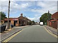
Newcastle-under-Lyme: Stanier Street
Image: © Jonathan Hutchins
Taken: 11 Jul 2015
0.03 miles
2
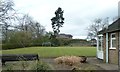
Newcastle-under-Lyme: Queen Elizabeth Park bowling green
The Corporation acquired this site in the 1930s, and in 1939 decided to convert it into a public park. War delayed the completion of this work, and it was formally opened in 1944. Facilities included this bowling green. On the far side of the green can be seen the remains of the motte of the castle which gave Newcastle its name - see http://www.geograph.org.uk/photo/4216996.
Image: © Jonathan Hutchins
Taken: 15 Apr 2015
0.04 miles
3
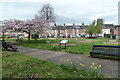
Newcastle-under-Lyme: Queen Elizabeth Park
The Corporation acquired this site in the 1930s, and in 1939 decided to convert it into a public park. War delayed the completion of this work, and it was formally opened in 1944. The area on the far side of the path is now a community food garden.
Image: © Jonathan Hutchins
Taken: 15 Apr 2015
0.05 miles
4
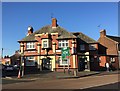
Newcastle-under-Lyme: John O'Gaunt
For a while called the 'Castle', because of its proximity to the remains of the town's castle, it has since reverted to its older name.
Image: © Jonathan Hutchins
Taken: 20 Jan 2015
0.05 miles
5
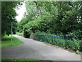
Newcastle-under-Lyme: path alongside Lyme Brook
Image: © Jonathan Hutchins
Taken: 11 Jul 2015
0.05 miles
6
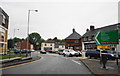
Pool Dam, Newcastle-under-Lyme
Where the A525 meets the inner ring road.
Image: © Bill Boaden
Taken: 24 Jul 2015
0.06 miles
7
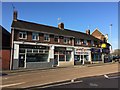
Newcastle-under-Lyme: shops at the top of Pool Dam
The Dancing Octopus is a charming name for a chippie, only slightly marred by the recent loss of the 'C' from the first word.
Image: © Jonathan Hutchins
Taken: 20 Jan 2015
0.06 miles
8
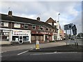
Shops at the top of Pool Dam
The only change from Image taken three years previously, is that the premises above Moments, formerly a fast-food outlet but closed for several months, have been refurbished and recently reopened as Pizza Triangle - Wood Fired Pizza.
Image: © Jonathan Hutchins
Taken: 21 Feb 2018
0.06 miles
9
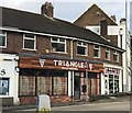
New pizza place in Newcastle
For a wider view see https://www.geograph.org.uk/photo/5688249
Image: © Jonathan Hutchins
Taken: 21 Feb 2018
0.06 miles
10
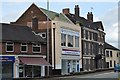
Newcastle-under-Lyme: former co-op
The central building in this photograph, 61-63 Lower Street, is currently occupied by Newcastle Housing Advice and GB Recruitment. However as the sign high on the side wall indicates, it was once one of Swettenhams Co-Operative Institutions. Swettenhams was a family firm founded in the 1890s, and became one of north Staffordshire's first grocery chains, which by issuing a dividend functioned as a co-operative society.
The urns crowning each corner of the building overflow with painted fruit and flowers like cornucopias, presumably also signifying bounty.
Image: © Jonathan Hutchins
Taken: 11 Jul 2015
0.06 miles