1
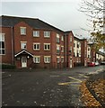
Newcastle-under-Lyme: Fletcher Bank from Dunkirk
Image: © Jonathan Hutchins
Taken: 29 Oct 2015
0.02 miles
2
Newcastle-under-Lyme: Castle Moat Court
These flats on Stanier Street are named for their rather loose proximity to the former site of the town's Castle.
Image: © Jonathan Hutchins
Taken: 29 Oct 2015
0.04 miles
3
Newcastle-Under-Lyme : Stanier Street
Looking along Stanier Street.
Image: © Lewis Clarke
Taken: 22 Sep 2019
0.05 miles
4
Newcastle-Under-Lyme : St Mary's Catholic Primary School
Entry into the school off Stanier Street.
Image: © Lewis Clarke
Taken: 22 Sep 2019
0.05 miles
5
Newcastle-Under-Lyme : St Mary's Catholic Primary School
Entry to the foundation stage classrooms.
Image: © Lewis Clarke
Taken: 22 Sep 2019
0.06 miles
6
Newcastle-under-Lyme: Castle Hill Road
Image: © Jonathan Hutchins
Taken: 16 Jul 2015
0.06 miles
7
Newcastle-under-Lyme: The Holborn, Castle Hill Road
As the sign over the door indicates, The Holborn was once the base of operations for the Newcastle Area Office of Staffordshire County Council's Social Services Department. In the mid-2000s this relocated to the Borough Council's Civic Offices, and since then the building is more or less a three-storey suite of junk rooms, though various proposals have been put forward for its use. The road leading down past the building towards St Giles' Church is also called Holborn: this is now rudely truncated by the A34 dual carriageway.
Image: © Jonathan Hutchins
Taken: 29 Oct 2015
0.06 miles
8
Newcastle-under-Lyme: Sutton House
A building divided into flats.
Image: © Jonathan Hutchins
Taken: 13 Aug 2016
0.06 miles
9
Waterloo Building's [sic]
A nineteenth-century example of 'apostrophitis' on the wall of a building currently occupied by the Newcastle-under-Lyme Labour Party.
For a view of the whole building see http://www.geograph.org.uk/photo/4969787
Image: © Jonathan Hutchins
Taken: 13 Sep 2014
0.07 miles
10
Newcastle-under-Lyme: Waterloo Buildings
For a close-up of this nineteenth-century example of apostrophitis see http://www.geograph.org.uk/photo/4163588
This is the headquarters of Newcastle's Labour Party. The red-and-white posters in the windows state VOTE REMAIN 23 JUNE, a reference to the forthcoming referendum on continued membership of the EU.
Image: © Jonathan Hutchins
Taken: 28 May 2016
0.07 miles


