Newcastle-under-Lyme: The Holborn, Castle Hill Road
Introduction
The photograph on this page of Newcastle-under-Lyme: The Holborn, Castle Hill Road by Jonathan Hutchins as part of the Geograph project.
The Geograph project started in 2005 with the aim of publishing, organising and preserving representative images for every square kilometre of Great Britain, Ireland and the Isle of Man.

There are currently over 7.5m images from over 14,400 individuals and you can help contribute to the project by visiting https://www.geograph.org.uk
Newcastle-under-Lyme: The Holborn, Castle Hill Road
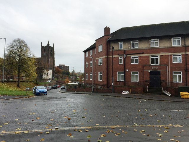
Image: © Jonathan Hutchins Taken: 29 Oct 2015
As the sign over the door indicates, The Holborn was once the base of operations for the Newcastle Area Office of Staffordshire County Council's Social Services Department. In the mid-2000s this relocated to the Borough Council's Civic Offices, and since then the building is more or less a three-storey suite of junk rooms, though various proposals have been put forward for its use. The road leading down past the building towards St Giles' Church is also called Holborn: this is now rudely truncated by the A34 dual carriageway.
Images are licensed for reuse under creativecommons.org/licenses/by-sa/2.0
Image Location
Latitude
53.012609
Longitude
-2.231877