1
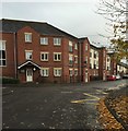
Newcastle-Under-Lyme : Stanier Street
Looking along Stanier Street.
Image: © Lewis Clarke
Taken: 22 Sep 2019
0.01 miles
2
Newcastle-under-Lyme: Castle Moat Court
These flats on Stanier Street are named for their rather loose proximity to the former site of the town's Castle.
Image: © Jonathan Hutchins
Taken: 29 Oct 2015
0.02 miles
3
Newcastle-Under-Lyme : St Mary's Catholic Primary School
Entry to the foundation stage classrooms.
Image: © Lewis Clarke
Taken: 22 Sep 2019
0.02 miles
4
Newcastle-Under-Lyme : St Mary's Catholic Primary School
Entry into the school off Stanier Street.
Image: © Lewis Clarke
Taken: 22 Sep 2019
0.03 miles
5
Newcastle-under-Lyme: Fletcher Bank from Dunkirk
Image: © Jonathan Hutchins
Taken: 29 Oct 2015
0.04 miles
6
Waterloo Building's [sic]
A nineteenth-century example of 'apostrophitis' on the wall of a building currently occupied by the Newcastle-under-Lyme Labour Party.
For a view of the whole building see http://www.geograph.org.uk/photo/4969787
Image: © Jonathan Hutchins
Taken: 13 Sep 2014
0.05 miles
7
Newcastle-under-Lyme: Waterloo Buildings
For a close-up of this nineteenth-century example of apostrophitis see http://www.geograph.org.uk/photo/4163588
This is the headquarters of Newcastle's Labour Party. The red-and-white posters in the windows state VOTE REMAIN 23 JUNE, a reference to the forthcoming referendum on continued membership of the EU.
Image: © Jonathan Hutchins
Taken: 28 May 2016
0.05 miles
8
Newcastle-Under-Lyme : Footpath
A footpath from Silverdale Road heading to Stanier Street.
Image: © Lewis Clarke
Taken: 22 Sep 2019
0.06 miles
9
Newcastle-Under-Lyme : St Mary's Catholic Primary School
The playground at St Mary's Catholic Primary School.
Image: © Lewis Clarke
Taken: 22 Sep 2019
0.07 miles
10
Newcastle-under-Lyme: footpath off Silverdale Road
This public footpath designated Newcastle FP 117, runs from Silverdale Road to join the end of Stanier Street, behind St Mary's Roman Catholic Primary School.
Image: © Jonathan Hutchins
Taken: 29 Oct 2015
0.07 miles


