
IMAGES TAKEN NEAR TO
Victoria Place, NEWCASTLE, ST5 0HL
Introduction
This page details the photographs taken nearby to Victoria Place, ST5 0HL by members of the Geograph project.
The Geograph project started in 2005 with the aim of publishing, organising and preserving representative images for every square kilometre of Great Britain, Ireland and the Isle of Man.

There are currently over 7.5m images from over14,400 individuals and you can help contribute to the project by visiting https://www.geograph.org.uk
Image Map
Images are licensed for reuse under creativecommons.org/licenses/by-sa/2.0
Notes
- Clicking on the map will re-center to the selected point.
- The higher the marker number, the further away the image location is from the centre of the postcode.
Image Listing (70 Images Found)
Images are licensed for reuse under creativecommons.org/licenses/by-sa/2.0
Image
Details
Distance
1
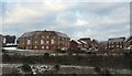
New housing development at Wolstanton
This new estate lies above the A500 and a new access road to the A527, and is here viewed from the car park of Wolstanton Retail Park on the opposite side of the access road. The banners proclaim the development is by Bloor Homes https://bloorhomes.com , who have named it 'Wulfstan Grange'; Wolstanton means 'Wulfstan's Town'. It is built on the site of the former sports field of Wolstanton Colliery; the colliery site itself is now home to the Retail Park.
Image: © Jonathan Hutchins
Taken: 30 Dec 2014
0.09 miles
4
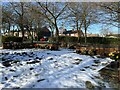
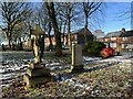
Memorial garden in St Margaret's churchyard (2)
Image: © Jonathan Hutchins
Taken: 21 Jan 2023
0.11 miles
5
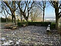
Memorial garden in St Margaret's churchyard (1)
Image: © Jonathan Hutchins
Taken: 21 Jan 2023
0.11 miles
6
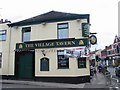
Village Tavern
On the corner of Lily Street
Image: © Clive Woolliscroft
Taken: 19 Jun 2006
0.11 miles
7

Access road to new housing estate off A527
Image: © Jonathan Hutchins
Taken: 21 Jan 2023
0.12 miles
8

St Margaret's graveyard, Wolstanton, Newcastle-under-Lyme
Looking east along a footpath in St Margaret's graveyard. Houses on Chetwynd Street are visible on the left.
Image: © Rod Grealish
Taken: 6 Jul 2025
0.12 miles
9

St Margaret's graveyard, Wolstanton, Newcastle-under-Lyme
The graveyard contains the grave of Sarah Smith, who died in 1763 aged 21. The inscription on her grave slab states that she was murdered by poisoning, and gives the first and last letters of the first name and surname of the alleged murderer. The grave is Grade II listed for "its highly unusual and poignant epitaph which records the infamous and tragic circumstances surrounding her death and as a good example of a mid-Georgian monument which, despite some damage, survives in its essential form with a legible inscription." (from Historic England listing)
The graveyard also contains the grave of Henry Faulds (1843–1930), a missionary who developed fingerprinting after using them to prove the innocence of a burglar when he was working in Japan.
Image: © Rod Grealish
Taken: 6 Jul 2025
0.12 miles
10
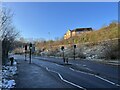
Pedestrian crossing on the A527
This is the former access road to the former colliery, now occupied by Wolstanton Retail Park. The A527 rises from its junction with the A500 up to Wolstanton and then turns south into the centre of Newcastle.
Image: © Jonathan Hutchins
Taken: 21 Jan 2023
0.12 miles