IMAGES TAKEN NEAR TO
Oaklands Avenue, NEWCASTLE, ST5 0DW
Introduction
This page details the photographs taken nearby to Oaklands Avenue, ST5 0DW by members of the Geograph project.
The Geograph project started in 2005 with the aim of publishing, organising and preserving representative images for every square kilometre of Great Britain, Ireland and the Isle of Man.

There are currently over 7.5m images from over14,400 individuals and you can help contribute to the project by visiting https://www.geograph.org.uk
Image Map
Images are licensed for reuse under creativecommons.org/licenses/by-sa/2.0
Notes
- Clicking on the map will re-center to the selected point.
- The higher the marker number, the further away the image location is from the centre of the postcode.
Image Listing (9 Images Found)
Images are licensed for reuse under creativecommons.org/licenses/by-sa/2.0
Image
Details
Distance
1
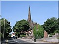
Wolstanton, Church of St Margaret
View of St Margaret's Church, Wolstanton, Newcastle-under-Lyme, SJ856480. The Church of St Margaret, with its lofty spire may be seen at a large distance. It contains several monuments of the Sneyd family, and a handsome stone pulpit, erected in 1848
Image: © Alan Fleming
Taken: 4 Sep 2005
0.17 miles
4
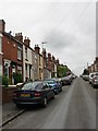
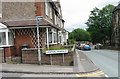
Heaton Terrace
Looking from Watlands View
Image: © Clive Woolliscroft
Taken: 19 Jun 2006
0.23 miles
5
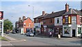
Wolstanton High Street
The northeast side of the street, with James Street and Emberton Street the roads joining on the right. My father was born in Wolstanton; this photo was taken, I would guess, well over 70 years after he last saw the place - I wonder how much has changed? Doubtless there were buildings on the left where the service station now is. And it seems unlikely that there would have been a sports massage parlour or a canine beautician.
Image: © Derek Harper
Taken: 30 Jun 2006
0.23 miles
6
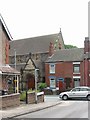
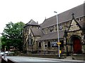
Heaton Terrace
Junction between Heaton Terrace and Watlands View and opposite St Andrew's Church, Porthill, which is visible.
Image: © Clive Woolliscroft
Taken: 19 Jun 2006
0.23 miles
7
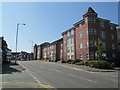
Wolstanton High Street
Looking south-east along High Street, at the junction (on the left in the foreground) with Emberton Street. The building on the right is Adlington House.
Image: © David Weston
Taken: 6 May 2018
0.25 miles
8
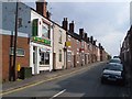
Lily Street, Wolstanton
Terraces climb from the High Street, with a Chinese take-away to Beijing with.
Image: © Derek Harper
Taken: 30 Jun 2006
0.25 miles