IMAGES TAKEN NEAR TO
Levi Smith Close, STOKE-ON-TRENT, ST4 8ZW
Introduction
This page details the photographs taken nearby to Levi Smith Close, ST4 8ZW by members of the Geograph project.
The Geograph project started in 2005 with the aim of publishing, organising and preserving representative images for every square kilometre of Great Britain, Ireland and the Isle of Man.

There are currently over 7.5m images from over14,400 individuals and you can help contribute to the project by visiting https://www.geograph.org.uk
Image Map
Images are licensed for reuse under creativecommons.org/licenses/by-sa/2.0
Notes
- Clicking on the map will re-center to the selected point.
- The higher the marker number, the further away the image location is from the centre of the postcode.
Image Listing (19 Images Found)
Images are licensed for reuse under creativecommons.org/licenses/by-sa/2.0
Image
Details
Distance
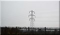
4
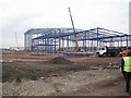
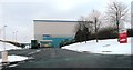
Warehousing Construction
Steelwork nearing completion for a warehouse on the site of the former Hem Heath colliery.
Image: © John Allan
Taken: Unknown
0.11 miles
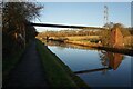
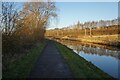
5
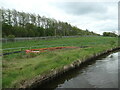
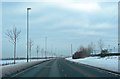
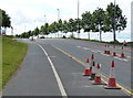
Security fences, construction site, Trentham
This field, between the canal and the railway, is the northern end of a large construction site. Farmland is giving way to housing.
Image: © Christine Johnstone
Taken: 1 May 2023
0.15 miles