IMAGES TAKEN NEAR TO
Hanford, STOKE-ON-TRENT, ST4 6ND
Introduction
This page details the photographs taken nearby to Hanford, ST4 6ND by members of the Geograph project.
The Geograph project started in 2005 with the aim of publishing, organising and preserving representative images for every square kilometre of Great Britain, Ireland and the Isle of Man.

There are currently over 7.5m images from over14,400 individuals and you can help contribute to the project by visiting https://www.geograph.org.uk
Image Map
Images are licensed for reuse under creativecommons.org/licenses/by-sa/2.0
Notes
- Clicking on the map will re-center to the selected point.
- The higher the marker number, the further away the image location is from the centre of the postcode.
Image Listing (19 Images Found)
Images are licensed for reuse under creativecommons.org/licenses/by-sa/2.0
Image
Details
Distance
1
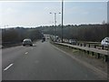
A500 - view west from the A34 flyover
Image: © Peter Whatley
Taken: 24 Mar 2011
0.01 miles
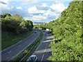
2
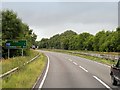
Westbound A500, Stoke "D" Road
The "D" Road was built to link the M6 motorway with the A34 north and south of the city of Stoke-on-Trent.
Image: © David Dixon
Taken: 8 Aug 2014
0.03 miles
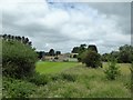
4
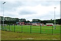
Stoke City Academy and Training Ground, Clayton Wood
Image: © Jonathan Hutchins
Taken: 18 Jun 2016
0.13 miles
5
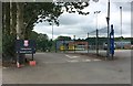
Stoke City Academy and Training Ground, Clayton Wood
Image: © Jonathan Hutchins
Taken: 18 Jun 2016
0.16 miles
7
Squeeze stile on footpath by Claytonwood Farm
Image: © Jonathan Hutchins
Taken: 18 Jun 2016
0.18 miles
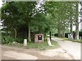
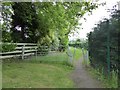
8
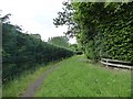
Footpath by Claytonwood Farm
On the left the boundary fence of Stoke City FC Academy, on the right the fence of Claytonwood Farm.
Image: © Jonathan Hutchins
Taken: 18 Jun 2016
0.18 miles
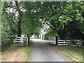
9
Michelin Sports and Conference Facility ('the MAC')
Set in 75 acres outside Stoke-on-Trent.
Image: © Jonathan Hutchins
Taken: 18 Jun 2016
0.18 miles