IMAGES TAKEN NEAR TO
The Avenue, STOKE-ON-TRENT, ST4 6DA
Introduction
This page details the photographs taken nearby to The Avenue, ST4 6DA by members of the Geograph project.
The Geograph project started in 2005 with the aim of publishing, organising and preserving representative images for every square kilometre of Great Britain, Ireland and the Isle of Man.

There are currently over 7.5m images from over14,400 individuals and you can help contribute to the project by visiting https://www.geograph.org.uk
Image Map
Images are licensed for reuse under creativecommons.org/licenses/by-sa/2.0
Notes
- Clicking on the map will re-center to the selected point.
- The higher the marker number, the further away the image location is from the centre of the postcode.
Image Listing (66 Images Found)
Images are licensed for reuse under creativecommons.org/licenses/by-sa/2.0
Image
Details
Distance
1
Newcastle-under-Lyme: Wayfield Grove
A short cul-de-sac off The Avenue. At its end is Newcastle-under-Lyme School rugby pitch.
Image: © Jonathan Hutchins
Taken: 3 Mar 2015
0.02 miles
3
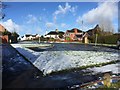
Newcastle-under-Lyme: Fosbrooke Place
A very short stub of a cul-de-sac. This is at the top of the grassy slope on the left in Image
Image: © Jonathan Hutchins
Taken: 30 Jan 2015
0.06 miles
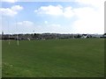
4
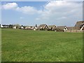
Newcastle-under-Lyme School playing fields
Image: © Jonathan Hutchins
Taken: 9 Apr 2015
0.06 miles
5
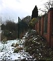
Hartshill: footpath boundary
This easily overlooked and barely passable suburban footpath is designated FP Newcastle 156 by the County Council. However it has some significance as forming, for the whole of its length until it meets the A34 to the SW, a section of the boundary between Newcastle-under-Lyme and the City of Stoke-on-Trent.
Image: © Jonathan Hutchins
Taken: 29 Jan 2015
0.07 miles
6
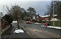
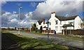
Hartshill: junction of Albany Road and The Avenue
Image: © Jonathan Hutchins
Taken: 29 Jan 2015
0.09 miles
7
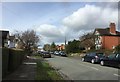
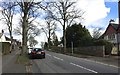
Newcastle-under-Lyme: Lancaster Road
Image: © Jonathan Hutchins
Taken: 27 Feb 2015
0.09 miles
8
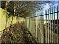
Footpath boundary behind Royal Stoke University Hospital
A little further north along Image] the path has widened out. Behind the railings on the right is the back of the hospital's multistorey car park.
Image: © Jonathan Hutchins
Taken: 30 Jan 2015
0.10 miles
9
Newcastle-under-Lyme School playing fields
Image: © Jonathan Hutchins
Taken: 9 Apr 2015
0.10 miles
10
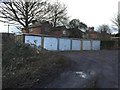
Hartshill: lock-up garages behind Albany Grove
Image: © Jonathan Hutchins
Taken: 4 Mar 2015
0.10 miles