1
Staffordshire and Worcestershire Canal near Penkridge
Housing in Walhouse Drive is at the southern developed tip of Penkridge.
Image: © Roger Kidd
Taken: 15 Oct 2011
0.03 miles
2
Staffordshire and Worcestershire Canal near Penkridge
Housing in Drake Avenue is at the southern developed tip of Penkridge.
Image: © Roger Kidd
Taken: 15 Oct 2011
0.05 miles
3
Canal approaching Penkridge in Staffordshire
This is the Staffordshire and Worcestershire Canal, looking north at Lynehill Bridge, No 83. The modern housing is in Drake Avenue.
Image: © Roger Kidd
Taken: 8 Sep 2019
0.05 miles
4
Canal cruising south of Penkridge in Staffordshire
This is the Staffordshire and Worcestershire Canal at the southern edge of Penkridge, looking south-east as the canal meanders towards Wolverhampton and Stourport.
Image: © Roger Kidd
Taken: 2 Sep 2012
0.05 miles
5
Lynehill Bridge near Penkridge in Staffordshire
Image: © Roger Kidd
Taken: 12 Jun 2010
0.07 miles
6
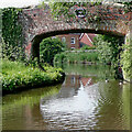
Lynehill Bridge south of Penkridge in Staffordshire
Lynehill Bridge is No 83 across the Staffordshire and Worcestershire Canal, south of Penkridge. Originally an accommodation bridge, it still carries a public footpath which crosses fields locally.
Image: © Roger D Kidd
Taken: 15 Aug 2013
0.07 miles
7
Lynehill Bridge south of Penkridge, Staffordshire
Lynehill Bridge is No 83 across the Staffordshire and Worcestershire Canal. It is an accommodation bridge which used to extend a very minor lane to the east of the canal. A public footpath still uses that route.
Image: © Roger D Kidd
Taken: 22 Oct 2011
0.07 miles
8
Lynehill Bridge south of Penkridge, Staffordshire
Lynehill Bridge is No 83 across the Staffordshire and Worcestershire Canal. It is an accommodation bridge which used to extend a very minor lane to the east of the canal. A public footpath still uses that route.
Image: © Roger D Kidd
Taken: 22 Oct 2011
0.07 miles
9
Lynehill Bridge south of Penkridge, Staffordshire
The bridge was probably an accommodation bridge. Now it carries a farm track which remains as a public footpath
Image: © Roger D Kidd
Taken: 24 May 2011
0.07 miles
10
Lyne Hill bridge over the Staffs & Worcs canal
The bridge carries a footpath on the southern side of Penkridge.
Image: © Richard Law
Taken: 14 Aug 2012
0.07 miles


