IMAGES TAKEN NEAR TO
Pinfold Lane, STAFFORD, ST19 5QP
Introduction
This page details the photographs taken nearby to Pinfold Lane, ST19 5QP by members of the Geograph project.
The Geograph project started in 2005 with the aim of publishing, organising and preserving representative images for every square kilometre of Great Britain, Ireland and the Isle of Man.

There are currently over 7.5m images from over14,400 individuals and you can help contribute to the project by visiting https://www.geograph.org.uk
Image Map
Images are licensed for reuse under creativecommons.org/licenses/by-sa/2.0
Notes
- Clicking on the map will re-center to the selected point.
- The higher the marker number, the further away the image location is from the centre of the postcode.
Image Listing (30 Images Found)
Images are licensed for reuse under creativecommons.org/licenses/by-sa/2.0
Image
Details
Distance
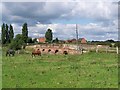
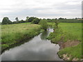
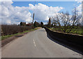
2
The River Penk near Penkridge
View from Cuttlestone Bridge.
Image: © JThomas
Taken: 10 Aug 2019
0.14 miles
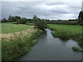
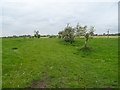
5
The River Penk from Cuttlestone Bridge
Near Penkridge in Staffordshire.
Image: © James Denham
Taken: 3 Aug 2009
0.16 miles
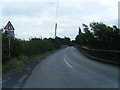
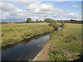
8
Cuttlestone Bridge
Historic crossing point over the River Penk.
Image: © John M
Taken: 17 Apr 2016
0.16 miles
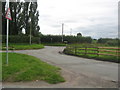
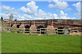
10
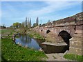
Cuttlestone Bridge and the Penk
The bridge itself is a Gr II listed structure, dating from the 18th century. It's suffered from a few vehicle strikes in recent years, as evidenced by a number of the parapet stones above the centre of the river, which are starting to overhang their original positions.
Image: © Richard Law
Taken: 25 Mar 2012
0.17 miles