1
River Penk in flood at Penkridge
This is looking east from the A449 road bridge
Image: © Stephen Grice
Taken: 16 Jan 2008
0.09 miles
2
Looking north along Marsh Lane, Penkridge
Image: © Richard Law
Taken: 22 Mar 2012
0.12 miles
3
Millend Cottage
An example of a 16th century timber framed cottage with later brick infill. The slate roof probably dates from 1984 together with the building to the rear.
For a glimpse of the original construction see http://www.bagnallvillage.com/Pages/millend.htm
Image: © John M
Taken: 3 Apr 2010
0.14 miles
4
Roller Mill
Converted watermill now used as a day centre by Age Concern. The mill appears some distance from the current channel of the River Penk but maybe had long mill leats.
Image: © John M
Taken: 3 Apr 2010
0.15 miles
5
Canalside housing in Penkridge, Staffordshire
The housing by the Staffordshire and Worcestershire Canal is in Leacroft Road, in the area known as The Marsh.
Image: © Roger Kidd
Taken: 28 Jul 2015
0.20 miles
6
Longford Lock nameboard
The Staffordshire and Worcestershire Canal Society has put these attractive nameboards by each lock on the canal
Image: © Nick Atty
Taken: 23 Jul 2001
0.20 miles
7
The Boat Pub and Bridge
This pub has been around for a long while on this canal and now serves narrow boat holidayers as well as locals. It is situated at the bridge, in the southern section of the grid square.
Image: © Pam Brophy
Taken: Unknown
0.20 miles
8
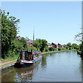
Staffordshire and Worcestershire Canal at Penkridge, Staffordshire
The Staffordshire and Worcestershire Canal was opened in 1772, and engineered by James Brindley. It cost a little over £100,000 at the time for its 46 mile course from Stourport to Great Haywood. There is plenty of mooring space for visitors.
Image: © Roger D Kidd
Taken: 21 Jun 2010
0.21 miles
9
Canal at Penkridge in Staffordshire
This is the Staffordshire and Worcestershire Canal in Penkridge, north of Penkridge Bridge, No 86.
Image: © Roger Kidd
Taken: 16 May 2019
0.21 miles
10
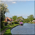
Canal at Penkridge in Staffordshire
This is the Staffordshire and Worcestershire Canal in Penkridge, north of Penkridge Bridge, No 86. There are good visitor moorings here.
Image: © Roger Kidd
Taken: 16 May 2019
0.21 miles


