
IMAGES TAKEN NEAR TO
Levedale Road, STAFFORD, ST19 5AT
Introduction
This page details the photographs taken nearby to Levedale Road, ST19 5AT by members of the Geograph project.
The Geograph project started in 2005 with the aim of publishing, organising and preserving representative images for every square kilometre of Great Britain, Ireland and the Isle of Man.

There are currently over 7.5m images from over14,400 individuals and you can help contribute to the project by visiting https://www.geograph.org.uk
Image Map
Images are licensed for reuse under creativecommons.org/licenses/by-sa/2.0
Notes
- Clicking on the map will re-center to the selected point.
- The higher the marker number, the further away the image location is from the centre of the postcode.
Image Listing (55 Images Found)
Images are licensed for reuse under creativecommons.org/licenses/by-sa/2.0
Image
Details
Distance
1
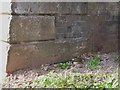
Cut benchmark on the railway bridge
A cut mark and bolt at the base of the sandstone pillar, on the north pier of the bridge, facing into Levedale Road. It was levelled at 265' above mean sea level, and used during the 1st Primary Levelling of England and Wales in the 1850s.
Image: © Richard Law
Taken: 25 Mar 2012
0.06 miles
2
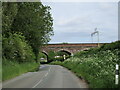
Levedale Road and Penkridge viaduct
Image: © Jonathan Thacker
Taken: 3 Jun 2021
0.08 miles
3
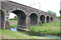
The Penkridge Viaduct, Penkridge
The Penkridge Viaduct which has 7 arches and foundations that were buried in concrete to a depth of 70 feet. The first train crossed Penkridge Viaduct on the 1st of June 1837 as a trial, and on the 4 July 1837 it was officially opened.
Image: © Mick Malpass
Taken: 22 Jun 2011
0.09 miles
4
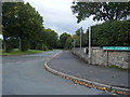
Levedale Road/Goods Station Lane junction
Image: © Colin Pyle
Taken: 10 Sep 2010
0.10 miles
5
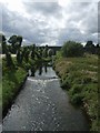
River Penk upstream at Penkridge
Looking towards the railway viaduct.
Image: © John M
Taken: 15 Aug 2009
0.10 miles
6
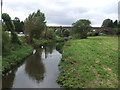
The River Penk, Penkridge
View towards the railway viaduct from the bridge on the A449.
Image: © JThomas
Taken: 10 Aug 2019
0.10 miles
7
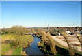
Railway crossing the River Penk north of Penkridge
Image: © Roy Hughes
Taken: 19 Mar 2022
0.10 miles
9
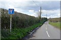
No through road down Preston Vale Lane
One day perhaps I might explore further!
Image: © John M
Taken: 17 Apr 2016
0.12 miles
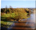
10
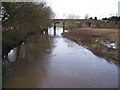
River Penk in Flood
Looking west through the railway viaduct. Taken from the A449 road bridge. Last summer in the major floods, the river was much above this level.
Image: © Stephen Grice
Taken: 16 Jan 2008
0.12 miles