Cut benchmark on the railway bridge
Introduction
The photograph on this page of Cut benchmark on the railway bridge by Richard Law as part of the Geograph project.
The Geograph project started in 2005 with the aim of publishing, organising and preserving representative images for every square kilometre of Great Britain, Ireland and the Isle of Man.

There are currently over 7.5m images from over 14,400 individuals and you can help contribute to the project by visiting https://www.geograph.org.uk
Cut benchmark on the railway bridge
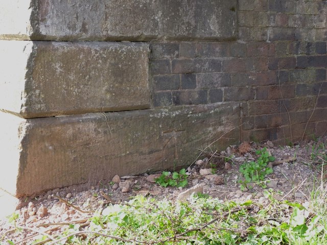
Image: © Richard Law Taken: 25 Mar 2012
A cut mark and bolt at the base of the sandstone pillar, on the north pier of the bridge, facing into Levedale Road. It was levelled at 265' above mean sea level, and used during the 1st Primary Levelling of England and Wales in the 1850s.
Images are licensed for reuse under creativecommons.org/licenses/by-sa/2.0
Image Location
Latitude
52.727921
Longitude
-2.118654