
IMAGES TAKEN NEAR TO
Pellfield Court, STAFFORD, ST18 0JG
Introduction
This page details the photographs taken nearby to Pellfield Court, ST18 0JG by members of the Geograph project.
The Geograph project started in 2005 with the aim of publishing, organising and preserving representative images for every square kilometre of Great Britain, Ireland and the Isle of Man.

There are currently over 7.5m images from over14,400 individuals and you can help contribute to the project by visiting https://www.geograph.org.uk
Image Map
Images are licensed for reuse under creativecommons.org/licenses/by-sa/2.0
Notes
- Clicking on the map will re-center to the selected point.
- The higher the marker number, the further away the image location is from the centre of the postcode.
Image Listing (94 Images Found)
Images are licensed for reuse under creativecommons.org/licenses/by-sa/2.0
Image
Details
Distance
1
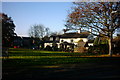
The Woolpack
A view of The Woolpack, a village pub in Weston, near Stafford.
Image: © Stephen Pearce
Taken: 7 Nov 2006
0.03 miles
3
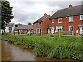
Recent housing in Weston, Staffordshire
Looking north-north-east from the Trent and Mersey Canal. Access by road is from Brandwood Drive or Castlemill Close.
Image: © Roger Kidd
Taken: 10 Sep 2019
0.07 miles
4
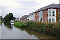
New canalside housing at Weston, Staffordshire
By the Trent and Mersey Canal, the current satellite images show this site before development. Salt Works Lane is nearby, as was the former site of Ingestre Station (closed in 1939). It is being marketed as Canalside Wharf development by Taylor Wimpey. http://www.primelocation.com/new-homes/developmentLocalinfo/dev/5464/
Image: © Roger D Kidd
Taken: 4 Sep 2011
0.07 miles
5
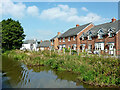
Canalside housing in Weston, Staffordshire
The housing is alongside the Trent and Mersey Canal, by Brandwood Drive and Castlemill Close.
Image: © Roger Kidd
Taken: 11 Sep 2014
0.07 miles
6

The Green, Weston
Looking across from Green Road.
Image: © David Weston
Taken: 23 May 2018
0.07 miles
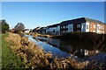
8
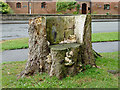
Stylish wooden seat on The Green at Weston, Staffordshire
The current satellite images show the tree as having had a spread of about sixteen metres. I suppose there was a good environmental reason for felling such a substantial tree.
Note: It had been removed by 2014.
Image: © Roger D Kidd
Taken: 3 Sep 2011
0.08 miles
9
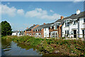
Canalside housing in Weston, Staffordshire
The housing is alongside the Trent and Mersey Canal, by Brandwood Drive and Castlemill Close.
Image: © Roger Kidd
Taken: 11 Sep 2014
0.08 miles
10
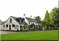
The Woolpack, Weston
Looking over The Green, also looking a bit damp after early morning rain.
Image: © Alan Murray-Rust
Taken: 23 Aug 2017
0.08 miles