
IMAGES TAKEN NEAR TO
Ten Butts Crescent, STAFFORD, ST17 9HP
Introduction
This page details the photographs taken nearby to Ten Butts Crescent, ST17 9HP by members of the Geograph project.
The Geograph project started in 2005 with the aim of publishing, organising and preserving representative images for every square kilometre of Great Britain, Ireland and the Isle of Man.

There are currently over 7.5m images from over14,400 individuals and you can help contribute to the project by visiting https://www.geograph.org.uk
Image Map
Images are licensed for reuse under creativecommons.org/licenses/by-sa/2.0
Notes
- Clicking on the map will re-center to the selected point.
- The higher the marker number, the further away the image location is from the centre of the postcode.
Image Listing (18 Images Found)
Images are licensed for reuse under creativecommons.org/licenses/by-sa/2.0
Image
Details
Distance
2
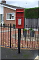
Elizabeth II postbox on Hill Farm Close, Moss Pit, Stafford
Postbox No. ST17 25.
See Image] for context.
Image: © JThomas
Taken: 10 Aug 2019
0.12 miles
3
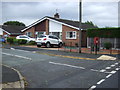
Bungalow on Hill Farm Close, Moss Pit, Stafford
Showing position of Postbox No. ST17 25.
See Image] for postbox.
Image: © JThomas
Taken: 10 Aug 2019
0.13 miles
7

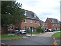
Moss Pit crossing, Stafford - (3)
A Birmingham bound London Midland 350 unit approaches the site of Moss Pit public crossing.
Image: © The Carlisle Kid
Taken: 24 May 2012
0.15 miles
8
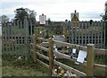
Stafford, level crossing
Ungated crossing from Gravel Lane to a footpath to Rickerscote; protected by stiles on either side. It appears from floral tributes and messages that there was a fatality here in 2010; presumably someone trying to cross the railway lines.
Image: © Mike Faherty
Taken: 15 Jan 2011
0.16 miles
9

Moss Pit crossing, Stafford - (1)
Site of former public right of way, now closed.
Image: © The Carlisle Kid
Taken: 24 May 2012
0.16 miles
10
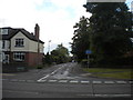
West end of School Lane, Moss Pit
Seen from the A449 Wolverhampton Road.
Image: © Richard Vince
Taken: 22 Jun 2015
0.16 miles