
IMAGES TAKEN NEAR TO
Tall Pines, STAFFORD, ST17 4QF
Introduction
This page details the photographs taken nearby to Tall Pines, ST17 4QF by members of the Geograph project.
The Geograph project started in 2005 with the aim of publishing, organising and preserving representative images for every square kilometre of Great Britain, Ireland and the Isle of Man.

There are currently over 7.5m images from over14,400 individuals and you can help contribute to the project by visiting https://www.geograph.org.uk
Image Map
Images are licensed for reuse under creativecommons.org/licenses/by-sa/2.0
Notes
- Clicking on the map will re-center to the selected point.
- The higher the marker number, the further away the image location is from the centre of the postcode.
Image Listing (134 Images Found)
Images are licensed for reuse under creativecommons.org/licenses/by-sa/2.0
Image
Details
Distance
1
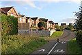
Ripon Drive at Wildwood in Stafford
Looking south towards Chepstow Drive. The footpath/cycleway links behind the camera to the A34 Radford Bank.
Image: © Roger Kidd
Taken: 17 Sep 2019
0.08 miles
2
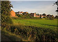
Housing by the Penk valley
Overlooking Radford Meadows, these houses are on Ripon Drive and Heronswood. View from the A34 Radford Bank.
Image: © Derek Harper
Taken: 6 Sep 2012
0.09 miles
3

Wildmoor nature pond
There has been a lot of housing development nearby but this pond on the edge of the marshy valley of the Penk has been preserved.
Image: © Bill Boaden
Taken: 7 Jul 2019
0.10 miles
4
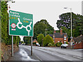
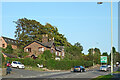
Radford Bank south-east of Stafford
This is the A34 Radford Bank about one and a quarter miles south-east of the town centre.
Image: © Roger Kidd
Taken: 4 Aug 2015
0.10 miles
5
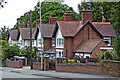
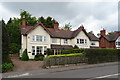
Radford Bank houses near Weeping Cross, Stafford
These houses are near the top of the A34 Radford Bank south-east of Stafford town centre.
Image: © Roger Kidd
Taken: 4 Aug 2015
0.10 miles
6
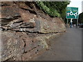
Strata at Weeping Cross
Some interesting strata in the A34 Radford Bank cutting near Weeping Cross,Stafford.
Image: © Tim Marshall
Taken: 13 Sep 2012
0.10 miles
8
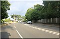
Radford Bank near Weeping Cross, Stafford
Radford Bank is the A34 (and A531), leading east-southeast towards Rugeley and Cannock.
Image: © Roger Kidd
Taken: 11 Sep 2014
0.11 miles
10
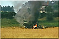
A harvesting disaster, 1975
Seen from a passing canal boat. To quote from the boat's log: "7:30 [p.m.] Slowed down to watch combine harvester on fire. Tyre blew up, smoke billowed & 2 fire engines and a police car roared up."
Image: © Robin Webster
Taken: 13 Aug 1975
0.11 miles