IMAGES TAKEN NEAR TO
Meadow Road, STAFFORD, ST17 4JQ
Introduction
This page details the photographs taken nearby to Meadow Road, ST17 4JQ by members of the Geograph project.
The Geograph project started in 2005 with the aim of publishing, organising and preserving representative images for every square kilometre of Great Britain, Ireland and the Isle of Man.

There are currently over 7.5m images from over14,400 individuals and you can help contribute to the project by visiting https://www.geograph.org.uk
Image Map
Images are licensed for reuse under creativecommons.org/licenses/by-sa/2.0
Notes
- Clicking on the map will re-center to the selected point.
- The higher the marker number, the further away the image location is from the centre of the postcode.
Image Listing (12 Images Found)
Images are licensed for reuse under creativecommons.org/licenses/by-sa/2.0
Image
Details
Distance
1
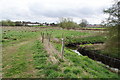
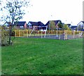
Path by a drainage ditch in Stafford
This is about 1 kilometre from the town centre. If it were not for the drain, the land would be impassable through marshiness. The land forms a green space between the developments alongside the A34 and the A449 to the south of Stafford.
Image: © Bill Boaden
Taken: 2 Apr 2011
0.07 miles
4

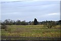
The Queensville curve, West Coast Main Line, Stafford looking south
The Queensville curve was built in 1846 as part of the direct line to Rugby at the point where it leaves the Stafford-Birmingham-Rugby route built in 1837. The line turns by 90 degrees here. Pendolino trains demonstrate their characteristic tilting on the curve.
Image: © Rod Grealish
Taken: 22 Aug 2025
0.17 miles
6
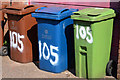
Bins - Stafford
Near the Queensville Curve footbridge. Location is approximate.
Image: © The Carlisle Kid
Taken: 25 May 2012
0.21 miles
7
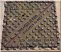
Access cover - Stafford
Near the Queensville Curve footbridge. Location is approximate.
Image: © The Carlisle Kid
Taken: 25 May 2012
0.21 miles
8
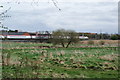
A Virgin Train on the way to Euston
The line passes a marshy area between the A34 and the A449.
Image: © Bill Boaden
Taken: 2 Apr 2011
0.21 miles