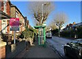
IMAGES TAKEN NEAR TO
Corporation Street, STAFFORD, ST16 3SW
Introduction
This page details the photographs taken nearby to Corporation Street, ST16 3SW by members of the Geograph project.
The Geograph project started in 2005 with the aim of publishing, organising and preserving representative images for every square kilometre of Great Britain, Ireland and the Isle of Man.

There are currently over 7.5m images from over14,400 individuals and you can help contribute to the project by visiting https://www.geograph.org.uk
Image Map
Images are licensed for reuse under creativecommons.org/licenses/by-sa/2.0
Notes
- Clicking on the map will re-center to the selected point.
- The higher the marker number, the further away the image location is from the centre of the postcode.
Image Listing (61 Images Found)
Images are licensed for reuse under creativecommons.org/licenses/by-sa/2.0
Image
Details
Distance
1
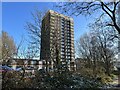
Tower block in Stafford
Pennycrofts Court is a 16-storey tower block approved in 1966 by Stafford Municipal County Borough (as it then was). There are 76 apartments, some of them in a two-storey extension which can be seen extending to the left from the tower.
Image: © Jonathan Hutchins
Taken: 16 Dec 2022
0.00 miles
2
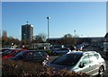
Pennycroft Flats
Looking across the ASDA car park towards Pennycroft Flats and the long low roof of the new Stafford Recreation Centre.
The tower block is built alongside the road that once emanated through the old Town Walls from the East Gate going to Littleworth, Weston and eventually Uttoxeter.
The old names of Littleworth and Penny Croft imply that this was not perhaps the best farmland in the area in medieval times!
Image: © Simon Huguet
Taken: 25 Nov 2008
0.01 miles
4
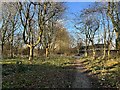
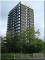
Path north of Lammascote Road
To the left is Kingsmead Marsh.
Image: © Jonathan Hutchins
Taken: 16 Dec 2022
0.04 miles
5
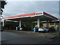
Service station on Lammascote Road, Stafford
Image: © JThomas
Taken: 7 Oct 2017
0.04 miles
6
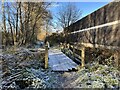
Footbridge over ditch
This wooden structure bridges one of the many drainage ditches which cross Kingsmead Marsh. To the right is the Pearl Brook.
Image: © Jonathan Hutchins
Taken: 16 Dec 2022
0.04 miles
8
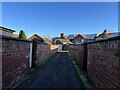
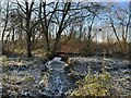
Alley between houses on Corporation Street
Image: © Jonathan Hutchins
Taken: 9 Dec 2022
0.06 miles
9

Stafford Leisure Centre
The new leisure centre complex was opened in April 2008. It replaces the old Riverside centre which was just opposite the tower block seen behind the pedestrians.
Image: © Simon Huguet
Taken: 7 Sep 2008
0.06 miles