
IMAGES TAKEN NEAR TO
Lema Way, STAFFORD, ST16 3LB
Introduction
This page details the photographs taken nearby to Lema Way, ST16 3LB by members of the Geograph project.
The Geograph project started in 2005 with the aim of publishing, organising and preserving representative images for every square kilometre of Great Britain, Ireland and the Isle of Man.

There are currently over 7.5m images from over14,400 individuals and you can help contribute to the project by visiting https://www.geograph.org.uk
Image Map
Images are licensed for reuse under creativecommons.org/licenses/by-sa/2.0
Notes
- Clicking on the map will re-center to the selected point.
- The higher the marker number, the further away the image location is from the centre of the postcode.
Image Listing (26 Images Found)
Images are licensed for reuse under creativecommons.org/licenses/by-sa/2.0
Image
Details
Distance
2

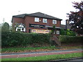
The Morris Man
The Morris Man public house, viewed from Allis Close.
Image: © David Dixon
Taken: 12 Apr 2011
0.12 miles
3

Sign for the Morris Man, Kingston Hill, Stafford
Image: © JThomas
Taken: 7 Oct 2017
0.13 miles

5
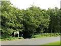
Entry to Kingston Pool Covert
Wet woodland habitat along a stream valley designated as a local nature reserve.
Image: © Alan Murray-Rust
Taken: 23 Aug 2017
0.18 miles
6
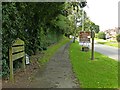
Welcome to the County Town of Stafford
Town Boundary sign on the A518, Weston Road. The actual town boundary is marked by the cast iron marker http://www.geograph.org.uk/photo/5510001 on the left.
Image: © Alan Murray-Rust
Taken: 23 Aug 2017
0.18 miles
7
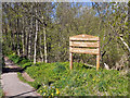
Kingston Pool Covert (South) Local Nature Reserve
The Birkdale Road entrance to the Local Nature Reserve.
Image: © David Dixon
Taken: 12 Apr 2011
0.19 miles
8
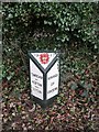
Old Boundary Marker by the A518, Weston Road, Stafford parish
Parish Boundary Marker by the A518, in parish of Stafford (Stafford District), Weston Road, between roundabout and Marlborough Avenue, entrance to nature reserve, on verge, South side of road.
Inscription reads:-
: TOWNSHIP / OF / HOPTON / AND / COTON : : 19{coat of arms}17 : : BOROUGH / OF / STAFFORD :
Surveyed
Milestone Society National ID: ST_SFHC01pb
Image: © Mike Faherty
Taken: 15 Jan 2011
0.19 miles
10
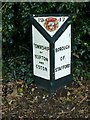
Boundary marker, Weston Road, Stafford
One of a series erected by the old Borough of Stafford on main roads. See http://www.geograph.org.uk/photo/5509998 for location.
Image: © Alan Murray-Rust
Taken: 23 Aug 2017
0.20 miles