Boundary marker, Weston Road, Stafford
Introduction
The photograph on this page of Boundary marker, Weston Road, Stafford by Alan Murray-Rust as part of the Geograph project.
The Geograph project started in 2005 with the aim of publishing, organising and preserving representative images for every square kilometre of Great Britain, Ireland and the Isle of Man.

There are currently over 7.5m images from over 14,400 individuals and you can help contribute to the project by visiting https://www.geograph.org.uk
Boundary marker, Weston Road, Stafford
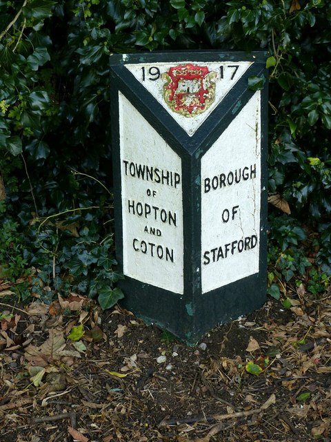
Image: © Alan Murray-Rust Taken: 23 Aug 2017
One of a series erected by the old Borough of Stafford on main roads. See http://www.geograph.org.uk/photo/5509998 for location.
Images are licensed for reuse under creativecommons.org/licenses/by-sa/2.0
Image Location
Latitude
52.810725
Longitude
-2.086746