IMAGES TAKEN NEAR TO
Courtland Mews, STAFFORD, ST16 3GR

Introduction

This page details the photographs taken nearby to Courtland Mews, ST16 3GR by members of the Geograph project.

The Geograph project started in 2005 with the aim of publishing, organising and preserving representative images for every square kilometre of Great Britain, Ireland and the Isle of Man.

There are currently over 7.5m images from over14,400 individuals and you can help contribute to the project by visiting https://www.geograph.org.uk

Image Map


Images are licensed for reuse under creativecommons.org/licenses/by-sa/2.0
Notes
  • Clicking on the map will re-center to the selected point.
  • The higher the marker number, the further away the image location is from the centre of the postcode.

Image Listing (11 Images Found)

Images are licensed for reuse under creativecommons.org/licenses/by-sa/2.0
Image
Details
Distance
1
Old Milepost by the B5066, Sandon Road, Stafford
Cast iron milepost by the B5066, in parish of Hopton and Coton (Stafford District), Stafford, North East of town centre, in path in front of low brick wall, on South East side of road. Lathe iron casting, erected by the County Council in the 19th/20th century. Inscription reads:- :STAFFORD 1 : : HOPTON / AND / COTON : : SANDON 3½ / MILWICH 6 / HILDERSTONE 7 / CHEADLE 15½ / LEEK 22½ : Maker:- : Chas. Lathe, Tipton. : Milestone Society National ID: ST_STLK01
Image: © J Higgins Taken: 1 Jan 2000
0.14 miles
2
Flooding on Sandon Road
A not infrequent sight in this part of Stafford after heavy rain.
Image: © Jonathan Hutchins Taken: 12 Jan 2023
0.15 miles
3
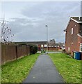
Access alley
Image: © Richard Taken: 9 Mar 2019
0.16 miles
4
Fairfield Court, off the B5066, Stafford
Image: © Mick Malpass Taken: 17 Jul 2011
0.16 miles
5
Astonfields Balancing Lakes, Stafford
A view of the South lake, from the spillway. The site is now treated as a nature reserve, with footpaths running along the perimeter.
Image: © Oliver Mills Taken: 14 Jul 2020
0.17 miles
6
Sandyford Brook
Image: © Jonathan Hutchins Taken: 12 Jan 2023
0.18 miles
7
Tap & Spile, Stafford
On Peel Terrace
Image: © Geoff Pick Taken: 15 Sep 2010
0.19 miles
8
Path on Stafford housing estate
Image: © Jonathan Hutchins Taken: 5 Jan 2023
0.21 miles
9
The Princess Royal, Stafford
Image: © Geoff Pick Taken: 15 Sep 2010
0.22 miles
10
Stafford Rangers ground
Marston Road, Stafford.
Image: © A Holmes Taken: 9 Feb 2008
0.23 miles