
IMAGES TAKEN NEAR TO
Paton Close, Tollgate Park, STAFFORD, ST16 3EG
Introduction
This page details the photographs taken nearby to Paton Close, Tollgate Park, ST16 3EG by members of the Geograph project.
The Geograph project started in 2005 with the aim of publishing, organising and preserving representative images for every square kilometre of Great Britain, Ireland and the Isle of Man.

There are currently over 7.5m images from over14,400 individuals and you can help contribute to the project by visiting https://www.geograph.org.uk
Image Map
Images are licensed for reuse under creativecommons.org/licenses/by-sa/2.0
Notes
- Clicking on the map will re-center to the selected point.
- The higher the marker number, the further away the image location is from the centre of the postcode.
Image Listing (14 Images Found)
Images are licensed for reuse under creativecommons.org/licenses/by-sa/2.0
Image
Details
Distance
1
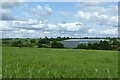
Part of Stafford Common
Designated as Open Access land, down to the hedge in front of the industrial building.
Image: © Alan Murray-Rust
Taken: 23 Aug 2017
0.05 miles
2
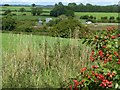
On the edge of Stafford
Looking across the valley of the Marston Brook. The field in the foreground is part of Stafford Common.
Image: © Alan Murray-Rust
Taken: 23 Aug 2017
0.06 miles

4

Old Boundary Marker by the A513, Beaconside, Stafford Parish
Parish Boundary Marker by the A513, in parish of Stafford (Stafford District), Parkside, at bridge over Marston Brook.
Surveyed
Milestone Society National ID: ST_SFCR02pb
Image: © M Bardell
Taken: Unknown
0.13 miles
5
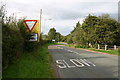
Common Road approaching Beaconside, Stafford
This is Common Road on the approach to the junction with Beaconside, north Stafford.
Image: © Stephen Pearce
Taken: 7 Oct 2006
0.13 miles
6
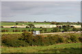
RAF Stafford
This is a view of RAF Stafford (the RAF is no longer in residence here - 2006) from Common Road. In the distance on the right is Hopton. In the foreground is Beaconside.
Image: © Stephen Pearce
Taken: 7 Oct 2006
0.13 miles
7
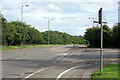
Beaconside
Beaconside is a part of the A513 forming Stafford's eastern by-pass. However, because a section of the by-pass has never been built it is detached from the rest of the A513 road. In this view Common Road leads off to the right across Stafford Common.
Image: © Stephen McKay
Taken: 24 Sep 2020
0.16 miles
8
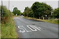
Common Road to A513 Beaconside Ring Road
Image: © Mick Malpass
Taken: 17 Jul 2011
0.18 miles
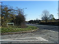
10
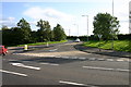
Common Road, Stafford
This is the junction of Common Road with Beaconside on the northern edge of Stafford.
Image: © Stephen Pearce
Taken: 7 Oct 2006
0.20 miles