IMAGES TAKEN NEAR TO
Marston Road, STAFFORD, ST16 3BU
Introduction
This page details the photographs taken nearby to Marston Road, ST16 3BU by members of the Geograph project.
The Geograph project started in 2005 with the aim of publishing, organising and preserving representative images for every square kilometre of Great Britain, Ireland and the Isle of Man.

There are currently over 7.5m images from over14,400 individuals and you can help contribute to the project by visiting https://www.geograph.org.uk
Image Map
Images are licensed for reuse under creativecommons.org/licenses/by-sa/2.0
Notes
- Clicking on the map will re-center to the selected point.
- The higher the marker number, the further away the image location is from the centre of the postcode.
Image Listing (53 Images Found)
Images are licensed for reuse under creativecommons.org/licenses/by-sa/2.0
Image
Details
Distance
1
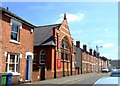
Christchurch, Rowley Street
Formerly a Wesleyan Mission Hall built for the shoe factory workers who lived in the terraced streets around it this C19th church is now shared by the Stafford Team Ministry [Church of England] and the Methodists.
Image: © Simon Huguet
Taken: 26 Jul 2008
0.09 miles
2
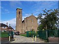
St Patrick's Catholic Church, Stafford
The church dates from 1953. Parish Website: http://www.stpatricksstafford.co.uk/index.asp
Image: © Geoff Pick
Taken: 15 Sep 2010
0.11 miles
3
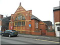
"The Church in Rowley Street"
Joint Methodist & Anglican. Originally a Wesleyan Mission Hall.
Image: © John Lord
Taken: 6 Feb 2017
0.11 miles
4
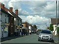
Marston Road, Stafford
Typical late 19th century suburban development
Image: © Alan Murray-Rust
Taken: 23 Aug 2017
0.11 miles
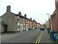
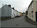
7
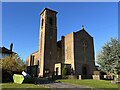
St Patrick's Roman Catholic Church, Stafford
Image: © Jonathan Hutchins
Taken: 25 Nov 2022
0.12 miles
8
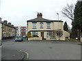
House in Tillington St, Stafford
At the corner of Lime Tree Av.
Image: © John Lord
Taken: 6 Feb 2017
0.12 miles
9
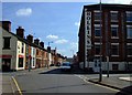
Rowley Street
Looking along Rowley Street towards Christchurch. The Hollins Business Centre to the right is a former shoe manufactory - Stafford was one of the centres of the shoe trade from the mid C19th up to the 1980s.
Image: © Simon Huguet
Taken: 26 Jul 2008
0.13 miles