
IMAGES TAKEN NEAR TO
Browning Street, STAFFORD, ST16 3AT
Introduction
This page details the photographs taken nearby to Browning Street, ST16 3AT by members of the Geograph project.
The Geograph project started in 2005 with the aim of publishing, organising and preserving representative images for every square kilometre of Great Britain, Ireland and the Isle of Man.

There are currently over 7.5m images from over14,400 individuals and you can help contribute to the project by visiting https://www.geograph.org.uk
Image Map
Images are licensed for reuse under creativecommons.org/licenses/by-sa/2.0
Notes
- Clicking on the map will re-center to the selected point.
- The higher the marker number, the further away the image location is from the centre of the postcode.
Image Listing (84 Images Found)
Images are licensed for reuse under creativecommons.org/licenses/by-sa/2.0
Image
Details
Distance
1
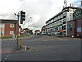
Looking up Browning Street from Greyfriars
Image: © Richard Law
Taken: 4 Nov 2020
0.01 miles
2
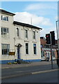
43 Foregate Street, Stafford
Built around 1840, 43 Foregate Street is described as 'a rare survival' of this type of town house. It attracted a Grade II listing https://britishlistedbuildings.co.uk/101211909-43-foregate-street-stafford-coton-ward#.YZPun2DP3IU & https://historicengland.org.uk/listing/the-list/list-entry/1211909 in 1951.
Image: © Richard Law
Taken: 4 Nov 2020
0.02 miles
3

The New Victoria, Stafford
This pub, in Browning Street, closed on November 30th, 2009
Image: © Geoff Pick
Taken: 7 May 2008
0.04 miles
4
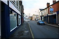
The Four Crosses
This is Gaol Road looking north to the Four Crosses and onwards into Marston Road. Browning Street goeds to the left and Sandon Road to the right. The Public House facing the junction is called The Four Crosses.
Image: © Stephen Pearce
Taken: 13 Nov 2006
0.04 miles
5
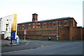
Stafford Prison on Gaol Road
The north walls of Stafford Prison on Crooked Bridge Road with Gaol Road in the front of the picture.
Image: © Stephen Pearce
Taken: 13 Nov 2006
0.04 miles
6
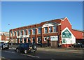
Former factory, Foregate Street
Once one of Stafford's shoe factories this building, dating from 1913, has been a bar and nightclub and once briefly had a lap-dancing bar in the basement. It is now an Indian restaurant.
Image: © Simon Huguet
Taken: 18 Jan 2009
0.05 miles
7
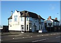
The Falcon
Situated on Foregate at the corner of Snow's Yard this was once the Falcon public house. It is now a Chinese takeaway and a chip shop. The former back yard opens out onto Greyfriars and now contains the Stafford Muslim Prayer Hall.
Image: © Simon Huguet
Taken: 18 Jan 2009
0.07 miles
8
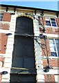
Former factory, St Patrick's Place
Detail of the loading bay and cast iron cranes at the end of the factory building.
Image: © Simon Huguet
Taken: 18 Jan 2009
0.08 miles
9
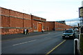
HMP Stafford
The Gates to Stafford Prison on Gaol Road, Stafford.
Image: © Stephen Pearce
Taken: 13 Nov 2006
0.08 miles
10
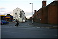
Crooked Bridge Road
Crooked Bridge Road at the junction of Gaol Road. Stafford Prison is on the right, in the distance is Prospect Road.
Image: © Stephen Pearce
Taken: 13 Nov 2006
0.08 miles