IMAGES TAKEN NEAR TO
Paterson Drive, STAFFORD, ST16 1WH

Introduction

This page details the photographs taken nearby to Paterson Drive, ST16 1WH by members of the Geograph project.

The Geograph project started in 2005 with the aim of publishing, organising and preserving representative images for every square kilometre of Great Britain, Ireland and the Isle of Man.

There are currently over 7.5m images from over14,400 individuals and you can help contribute to the project by visiting https://www.geograph.org.uk

Image Map


Images are licensed for reuse under creativecommons.org/licenses/by-sa/2.0
Notes
  • Clicking on the map will re-center to the selected point.
  • The higher the marker number, the further away the image location is from the centre of the postcode.

Image Listing (9 Images Found)

Images are licensed for reuse under creativecommons.org/licenses/by-sa/2.0
Image
Details
Distance
1
New Housing Development off the A513
Image: © Anthony Parkes Taken: 13 Jun 2014
0.10 miles
2
Parkside avenue/Beaconside junction
Image: © Colin Pyle Taken: 6 Nov 2010
0.11 miles
3
Taylor Wimpey Marston Grange Development
Taylor Wimpey, one of the UK's major house builders, is developing land to the north of the A513 Beaconside on the northern edge of Stafford. The sales office is on the left at the end of Newbold Drive with the show homes adjacent. This forms part of the North Stafford Strategic Development Location which will eventually comprise 3,100 homes; further land has been identified for employment to the west of the A34.
Image: © Stephen McKay Taken: 24 Sep 2020
0.11 miles
4
Lawnsfield Walk, Stafford
Image: © Mick Malpass Taken: 17 Jul 2011
0.15 miles
5
Borough of Stafford Boundary Post
In 1917 the boundaries of the Borough of Stafford were expanded and a series of attractive boundary posts were erected showing the name of the adjoining parish. This one is located on Stone Road, at the junction with Beaconside. See also Image
Image: © Stephen McKay Taken: 24 Sep 2020
0.20 miles
6
Hurricane Close, Stafford Audi
Car dealership on Hurricane Close.
Image: © David Dixon Taken: 4 Feb 2019
0.23 miles
7
A34 Stone Road
Image: © Colin Pyle Taken: 10 Jul 2010
0.24 miles
8
Closed footpath by the A34
On the right is the roundabout at the junction of the A34 and A513. There are major roadworks on the A34 just ahead, which have necessitated the closure of the footpath.
Image: © Bill Boaden Taken: 20 Sep 2013
0.24 miles
9
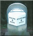
Replica Milestone by the A34, Stone Road, Stafford
Metal plate attached to stone post by the A34, in parish of Creswell (Stafford District), Trinity Fields, Stone Road, North of lay-by, North of Stafford by-pass, on the verge in front of hedge, on West side of road. Stafford V iron plate on stone, the original was erected by the Stone, Stafford & Penkridge turnpike trust in the 19th century. The original stone was placed at the Northern end of the lay-by during roadworks, however, it disappeared between 2011 and 2012. By 2015 a new pavement/cycleway was installed and a new stone and plate was set up slightly further North of the lay-by. This photo is of the new stone. Inscription reads:- : STONE / 5 / MILES : : TILLINGTON : : STAFFORD 2 / MILES : The original stone was Grade II listed. List Entry Number: 1392684 https://historicengland.org.uk/listing/the-list/list-entry/1392684 Milestone Society National ID: ST_SNST05
Image: © J Higgins Taken: Unknown
0.24 miles