Borough of Stafford Boundary Post
Introduction
The photograph on this page of Borough of Stafford Boundary Post by Stephen McKay as part of the Geograph project.
The Geograph project started in 2005 with the aim of publishing, organising and preserving representative images for every square kilometre of Great Britain, Ireland and the Isle of Man.

There are currently over 7.5m images from over 14,400 individuals and you can help contribute to the project by visiting https://www.geograph.org.uk
Borough of Stafford Boundary Post
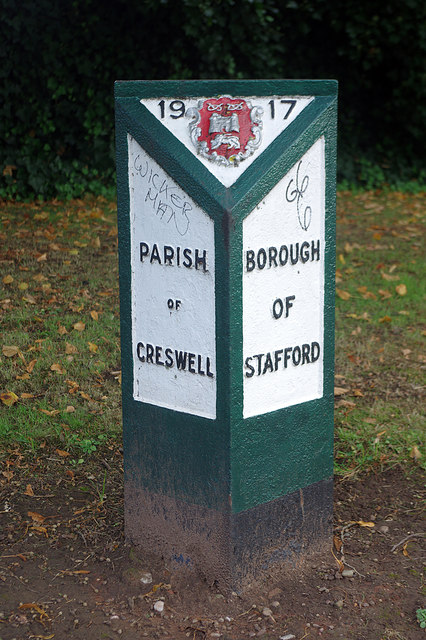
Image: © Stephen McKay Taken: 24 Sep 2020
In 1917 the boundaries of the Borough of Stafford were expanded and a series of attractive boundary posts were erected showing the name of the adjoining parish. This one is located on Stone Road, at the junction with Beaconside. See also Image
Images are licensed for reuse under creativecommons.org/licenses/by-sa/2.0
Image Location
Latitude
52.832168
Longitude
-2.131614