IMAGES TAKEN NEAR TO
Downfield Grove, STAFFORD, ST16 1TD
Introduction
This page details the photographs taken nearby to Downfield Grove, ST16 1TD by members of the Geograph project.
The Geograph project started in 2005 with the aim of publishing, organising and preserving representative images for every square kilometre of Great Britain, Ireland and the Isle of Man.

There are currently over 7.5m images from over14,400 individuals and you can help contribute to the project by visiting https://www.geograph.org.uk
Image Map (Loading...)


Getting Data...Please wait
Leaflet Map data © OpenStreetMap
Images are licensed for reuse under creativecommons.org/licenses/by-sa/2.0
Notes
- Clicking on the map will re-center to the selected point.
- The higher the marker number, the further away the image location is from the centre of the postcode.
Image Listing (18 Images Found)
Images are licensed for reuse under creativecommons.org/licenses/by-sa/2.0
Image
Details
Distance
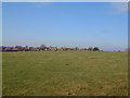
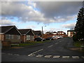
1
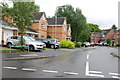
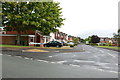
Parkside Avenue, Parkside
The estate's distributor road, seen from the junction with Ashdale Drive (left). As seems common in estates of this vintage, very little housing actually fronts onto Parkside Avenue itself.
Image: © Richard Vince
Taken: 11 Jan 2014
0.04 miles
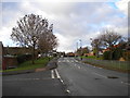
2
Linksfield Grove, Parkside
A residential cul de sac off Parkside Avenue, the estate's main distributor road.
Image: © Richard Vince
Taken: 11 Jan 2014
0.06 miles
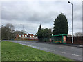
3
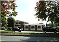
The Staffordshire Bull, Parkside.
Named for Staffordshire's famous Bull Terriers.
Image: © Simon Huguet
Taken: 18 Sep 2008
0.11 miles
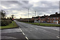
7
Stone Road, Stafford, looking south
A section of the Stone Road (A34) in Stafford. The Redhill roundabout is behind the photographer. The road become a single carriageway just beyond the curve to the right. The single carriageway section can just be made out in the background beyond the northbound carriageway. The start of Crab Lane is visible on the right leaving the northbound carriageway,
Image: © Rod Grealish
Taken: 17 Oct 2023
0.16 miles
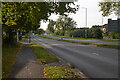
9
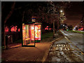
Bus Shelter on Stone Road
The A34 heading into Stafford.
Image: © David Dixon
Taken: 3 Feb 2019
0.20 miles