
IMAGES TAKEN NEAR TO
Waterloo Road, STOKE-ON-TRENT, ST1 5DT
Introduction
This page details the photographs taken nearby to Waterloo Road, ST1 5DT by members of the Geograph project.
The Geograph project started in 2005 with the aim of publishing, organising and preserving representative images for every square kilometre of Great Britain, Ireland and the Isle of Man.

There are currently over 7.5m images from over14,400 individuals and you can help contribute to the project by visiting https://www.geograph.org.uk
Image Map
Images are licensed for reuse under creativecommons.org/licenses/by-sa/2.0
Notes
- Clicking on the map will re-center to the selected point.
- The higher the marker number, the further away the image location is from the centre of the postcode.
Image Listing (27 Images Found)
Images are licensed for reuse under creativecommons.org/licenses/by-sa/2.0
Image
Details
Distance
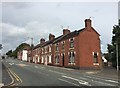
2
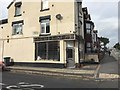
Cobridge: derelict shop on the corner of Winifred Street
Image: © Jonathan Hutchins
Taken: 24 Sep 2016
0.03 miles
3
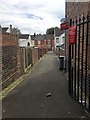
Hanley: alley off Portland Street
Image: © Jonathan Hutchins
Taken: 24 Sep 2016
0.04 miles
4
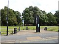
Cycleway off the A50 Waterloo Road in Stoke
On the opposite side of the road is http://www.geograph.org.uk/photo/5142756
Image: © Jonathan Hutchins
Taken: 24 Sep 2016
0.05 miles
5
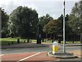
Footpath off the A50 Waterloo Road in Stoke
Designated as 'Etruria Loop Line'. On the opposite side of the road is http://www.geograph.org.uk/photo/5142759
Image: © Jonathan Hutchins
Taken: 24 Sep 2016
0.06 miles
6
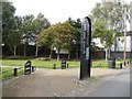
Hanley: footpath off the A50
Designated as 'Etruria Loop Line'.
Image: © Jonathan Hutchins
Taken: 24 Sep 2016
0.06 miles
8
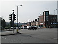
Crossroads, Cobridge
Looking along the A50 (Waterloo Road, which leads to Hanley) where it intersects with the A53 (Elder Road to the left, Cobridge Road to the right).
Image: © David Weston
Taken: 18 Jul 2013
0.14 miles
9
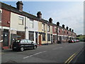
Crane Street, Cobridge
Near the crossroads of the A50 and A53. Most of the houses in the street are empty and boarded up, a few are occupied.
Image: © David Weston
Taken: 18 Jul 2013
0.15 miles
10
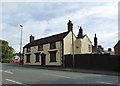
Cobridge: 342 Cobridge Road
This eighteenth-century Grade II listed building is the former 'Black Boy' inn.
For much detail on its history and fortunes see http://www.thepotteries.org/old_pubs/007.htm
Historic England entry: https://www.historicengland.org.uk/listing/the-list/list-entry/1195829
Image: © Jonathan Hutchins
Taken: 24 Sep 2016
0.17 miles