1
Newcastle Road in Stone, Staffordshire
This is the B5027, Looking north-west towards Newcastle-under-Lyme from the canal bridge.
Image: © Roger Kidd
Taken: 31 Aug 2009
0.01 miles
2
Newcastle Road in Stone, Staffordshire
Newcastle Road is the B5027, looking north-west from the bridge over the Trent and Mersey Canal.
Image: © Roger Kidd
Taken: 31 May 2011
0.01 miles
3
The B5027 Newcastle Road, Stone
Image: © Roy Hughes
Taken: 19 Mar 2022
0.03 miles
4
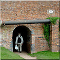
Footpath tunnel beside the Trent & Mersey Canal
Carries the footpath under Newcastle Road, Stone - but mind your head!
Image: © John Lucas
Taken: 18 Sep 2016
0.03 miles
5
Newcastle Road Bridge No 95
Next to Stone Lock No 29 on the Trent & Mersey Canal, in the Staffordshire market town of Stone.
Image: © Mat Fascione
Taken: 4 Jul 2015
0.04 miles
6
Towpath tunnel in Stone, Staffordshire
Looking north, the towpath tunnel leads under Newcastle Road by Newcastle Road Lock on the Trent and Mersey Canal.
Image: © Roger Kidd
Taken: 31 Aug 2009
0.04 miles
7
Horse tunnel by the canal at Stone, Staffordshire
This Grade II listed bridge structure was built c 1771-1772 and carries the B5027 (formerly the old A51) over the Trent and Mersey Canal. Newcastle Road Lock (No 29) is through the bridge arch. Horses had to be unhitched and led through their own tunnel, shown here.
Image]
Image: © Roger D Kidd
Taken: 3 Sep 2011
0.04 miles
8
Horse tunnel by the canal at Stone, Staffordshire
This Grade II listed bridge structure was built c 1771-1772 and carries the B5027 (formerly the old A51) over the Trent and Mersey Canal. Newcastle Road Lock (No 29) is through the bridge arch. Horses had to be unhitched and led through their own tunnel, shown here.
Image]
Image]
Image: © Roger D Kidd
Taken: 3 Sep 2011
0.04 miles
9
Newcastle Road Lock 29, Trent and Mersey Canal
Image: © Jo and Steve Turner
Taken: 15 Jun 1997
0.04 miles
10
Bridge (No 95), Trent and Mersey Canal, Stone
This bridge leads straight into the third lock of the Stone flight of four. The towpath arch is made for people about five feet (152cm) tall, so be prepared to duck your head!
Image: © Roger D Kidd
Taken: 12 Oct 2007
0.04 miles


