
IMAGES TAKEN NEAR TO
Bridge Crescent, STONE, ST15 0EZ
Introduction
This page details the photographs taken nearby to Bridge Crescent, ST15 0EZ by members of the Geograph project.
The Geograph project started in 2005 with the aim of publishing, organising and preserving representative images for every square kilometre of Great Britain, Ireland and the Isle of Man.

There are currently over 7.5m images from over14,400 individuals and you can help contribute to the project by visiting https://www.geograph.org.uk
Image Map
Images are licensed for reuse under creativecommons.org/licenses/by-sa/2.0
Notes
- Clicking on the map will re-center to the selected point.
- The higher the marker number, the further away the image location is from the centre of the postcode.
Image Listing (51 Images Found)
Images are licensed for reuse under creativecommons.org/licenses/by-sa/2.0
Image
Details
Distance
1
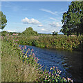
River Trent near Stone in Staffordshire
Looking east (upstream) as the River Trent meanders through Stone.
Image: © Roger Kidd
Taken: 29 Jul 2015
0.08 miles
2
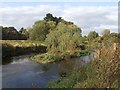
River Trent - south of Stone
There are no fish left alive in the river at Stone following a recent pollution incident involving a release of cyanide and untreated sewage below Stoke.
Image: © John M
Taken: 17 Oct 2009
0.09 miles
3
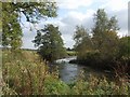
River Trent downstream of Stone
Looking across the flood meadow towards the spire of Aston-by-Stone church.
Image: © John M
Taken: 17 Oct 2009
0.09 miles
4
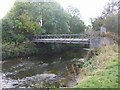
Sewage pipe bridge over the River Trent
Downstream of Walton Bridge.
Image: © John M
Taken: 17 Oct 2009
0.11 miles
5
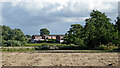
Farmland near Walton in Stone, Staffordshire
A telephoto assisted image, looking south-east from Westbridge Park. The houses are by Valley Road near Greenway Avenue.
Image: © Roger Kidd
Taken: 29 Jul 2015
0.11 miles
6

Farmland near Stone in Staffordshire
Looking south-east along the River Trent flood plain, from Westbridge Park. The distant houses are by Valley Road near Greenway Avenue.
Image: © Roger Kidd
Taken: 29 Jul 2015
0.12 miles
9
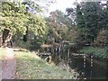
River Trent - Slalom course at Stone
A series of stone walls channel the flow at the gates. River flows are low following a relatively dry period. There would have been no action here last weekend as the Environment Agency issued warnings about a cyanide pollution incident.
Image: © John M
Taken: 17 Oct 2009
0.15 miles
10
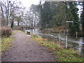
Stone Canoe Course
The view near Walton Bridge on the Stafford Road, Stone.
Image: © Gordon Griffiths
Taken: 5 Feb 2010
0.16 miles