
IMAGES TAKEN NEAR TO
Josiah Wedgwood Street, STOKE-ON-TRENT, ST1 4DG
Introduction
This page details the photographs taken nearby to Josiah Wedgwood Street, ST1 4DG by members of the Geograph project.
The Geograph project started in 2005 with the aim of publishing, organising and preserving representative images for every square kilometre of Great Britain, Ireland and the Isle of Man.

There are currently over 7.5m images from over14,400 individuals and you can help contribute to the project by visiting https://www.geograph.org.uk
Image Map
Images are licensed for reuse under creativecommons.org/licenses/by-sa/2.0
Notes
- Clicking on the map will re-center to the selected point.
- The higher the marker number, the further away the image location is from the centre of the postcode.
Image Listing (55 Images Found)
Images are licensed for reuse under creativecommons.org/licenses/by-sa/2.0
Image
Details
Distance
1
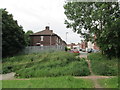
Josiah Wedgwood Street, Etruria
Seen from waste ground where there was once a railway line.
Image: © David Weston
Taken: 10 Jul 2015
0.04 miles
2

Sandon Street, Etruria
Taken on a day the wheelie-bins were in front of properties, unfortunately, but they are mostly obscured by the cars.
Image: © David Weston
Taken: 10 Jul 2015
0.05 miles
3
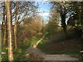
Etruria: route of the Potteries Loop Line
This footpath between Hanley and Etruria is one of the few remaining identifiable sections of the Potteries Loop Line.
Image: © Jonathan Hutchins
Taken: 20 Apr 2015
0.08 miles
4
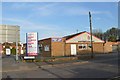
Hanley: Plus Display on Josiah Wedgwood Street
Plus Display create banner stands and pop-up stands and other graphics products. Their car park is shared with the pub on the left in the background.
Image: © Jonathan Hutchins
Taken: 20 Apr 2015
0.10 miles
5
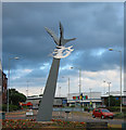
'The Pace of Recovery', Etruria
Stainless steel sculpture by Francis Gomila depicting a swan, dated 29 March 1994. Located on mini-roundabout at the junction of Festival Way and Marina Drive in the Etruria area of Stoke-on-Trent. The area formerly housed a steelworks, now redeveloped with a cinema and bowling alley. More details here: http://www.pmsa.org.uk/pmsa-database/7317/
Image: © Espresso Addict
Taken: 29 Jul 2006
0.10 miles
6
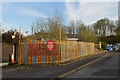
Hanley: shared car parking on Twemlow Street
The red sign states: This car park for use of Plough pub and Plus Display only. Plus Display is at http://www.geograph.org.uk/photo/4441655.
Image: © Jonathan Hutchins
Taken: 20 Apr 2015
0.11 miles
7
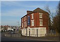
Etruria: former pub
Standing on the corner of Cobridge Road and Etruria Road, this was formerly a pub called the Rose and Crown. It is now occupied by BRB Independent Financial Advisors. More images at http://www.thepotteries.org/old_pubs/006.htm.
Image: © Jonathan Hutchins
Taken: 20 Apr 2015
0.11 miles
9
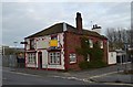
Etruria: The Old Plough
The Old Plough closed following the retirement of the couple who had run the pub since 1993. The building was originally a pair of semi-detached houses before becoming a greengrocer's, and then a 'beer house' around 1874. This photograph was taken a month before the pub's sale by public auction.
Image: © Jonathan Hutchins
Taken: 13 Apr 2015
0.12 miles
10
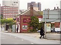
The Old Plough, Hanley
Steakhouse in 2012, but latterly a Papa John's Pizza house.
Image: © Eirian Evans
Taken: 26 Sep 2012
0.12 miles