IMAGES TAKEN NEAR TO
Moor Grove, UTTOXETER, ST14 7PT
Introduction
This page details the photographs taken nearby to Moor Grove, ST14 7PT by members of the Geograph project.
The Geograph project started in 2005 with the aim of publishing, organising and preserving representative images for every square kilometre of Great Britain, Ireland and the Isle of Man.

There are currently over 7.5m images from over14,400 individuals and you can help contribute to the project by visiting https://www.geograph.org.uk
Image Map (Loading...)


Getting Data...Please wait
Leaflet Map data © OpenStreetMap
Images are licensed for reuse under creativecommons.org/licenses/by-sa/2.0
Notes
- Clicking on the map will re-center to the selected point.
- The higher the marker number, the further away the image location is from the centre of the postcode.
Image Listing (10 Images Found)
Images are licensed for reuse under creativecommons.org/licenses/by-sa/2.0
Image
Details
Distance
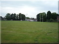
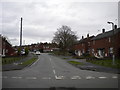
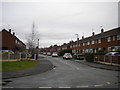
1
Holly Road, Uttoxeter
Seen from the end of Byrds Lane.
Image: © Richard Vince
Taken: 22 Feb 2020
0.04 miles
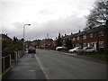
3
West end of Windsor Road, Uttoxeter
Seen from Pennycroft Road.
Image: © Richard Vince
Taken: 22 Feb 2020
0.15 miles
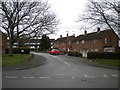
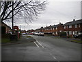
4
South end of Pennycroft Road, Uttoxeter
Seen from Byrds Lane.
Image: © Richard Vince
Taken: 22 Feb 2020
0.15 miles
5
Byrds Lane, Uttoxeter (2)
Seen from near the junction with Pennycroft Road.
Image: © Richard Vince
Taken: 22 Feb 2020
0.18 miles
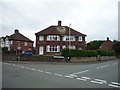
6
Pennycroft Road, Uttoxeter
Seen from the end of Lightfoot Road.
Image: © Richard Vince
Taken: 22 Feb 2020
0.19 miles
8
South end of Copes Way, Uttoxeter
Seen from Lightfoot Road.
Image: © Richard Vince
Taken: 22 Feb 2020
0.22 miles
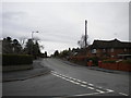
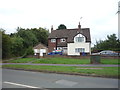
9
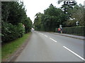
Stone Road, Uttoxeter
Looking east on the B5027.
Image: © JThomas
Taken: 27 Aug 2016
0.23 miles