1
Churnet Row, High Street, Rocester
Three-storey cottages, perhaps built to house mill workers.
Image: © Humphrey Bolton
Taken: 6 Jul 1999
0.00 miles
2
Primitive Methodist Chapel, Rocester
Image: © Humphrey Bolton
Taken: 11 Nov 2009
0.03 miles
3
Rocester Corn Mill
Now the office of JCB Finance
Image: © Chris Allen
Taken: 8 Aug 2015
0.03 miles
4
Looking past Churnet Bridge
The bridge over the River Churnet is to the left and the building over the river is an old mill, since repurposed and renovated by JCB as the financial department. There are two new additions, which match the size of the old mill, behind that are invisible in this view.
Image: © Malcolm Neal
Taken: 18 Oct 2023
0.03 miles
5
River Churnet at Rocester
What a lovely place to be on St Valentine's Day
Image: © Rog Frost
Taken: 14 Feb 2002
0.03 miles
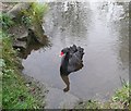
6
Black Swan, Rocester
On the River Churnet. It belongs to JCB.
Image: © Humphrey Bolton
Taken: 11 Nov 2009
0.03 miles
7
The River Churnet, Rocester
The bridge carries the B5030 bypass road. The resident black swan was investigating whether I had brought food.
Image: © Humphrey Bolton
Taken: 11 Nov 2009
0.03 miles
8
Rocester Corn Mill
There has been a corn mill on the Churnet at Rocester for centuries. This mill was originally powered by an undershot wheel, on the right-hand side where the sluices now are. The wheel has now been replaced by a 58kW turbine for generating electricity and the building is now the offices of JCB Finance.
Image: © Ian Calderwood
Taken: 5 Mar 2010
0.03 miles
9
Podmore's Mill
Image: © Peter Jeffery
Taken: 1 Jan 1956
0.04 miles
10
Podmore's flour Mill & weir, Rocester
SK 1039-1139
10/165
ROCESTER C.P.
HIGH STREET (South side)
Podmore's Mill
GV
II
Cotton mill. Late C19. Rock faced ashlar; clay tile roof; rock faced integral end stack. Three storeys; eight windows to first floor; four to second floor, six to ground floor, those to first and second floors are evenly spaced, ground floor windows match positions of first floor windows except fourth and sixth positions from left which are blank, segmental headed casements. Considerable group and landscape.
https://britishlistedbuildings.co.uk/101231923
Image: © Brian Deegan
Taken: 26 May 2020
0.05 miles


