
IMAGES TAKEN NEAR TO
Leek Road, LEEK, ST13 7HH
Introduction
This page details the photographs taken nearby to Leek Road, ST13 7HH by members of the Geograph project.
The Geograph project started in 2005 with the aim of publishing, organising and preserving representative images for every square kilometre of Great Britain, Ireland and the Isle of Man.

There are currently over 7.5m images from over14,400 individuals and you can help contribute to the project by visiting https://www.geograph.org.uk
Image Map
Images are licensed for reuse under creativecommons.org/licenses/by-sa/2.0
Notes
- Clicking on the map will re-center to the selected point.
- The higher the marker number, the further away the image location is from the centre of the postcode.
Image Listing (150 Images Found)
Images are licensed for reuse under creativecommons.org/licenses/by-sa/2.0
Image
Details
Distance
1
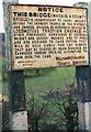
Old Bridge Marker by the A520, Cheddleton
Bridge Marker by the A520, in parish of Cheddleton (Staffordshire Moorlands District), was at Caldon Canal Bridge, is now 100m to North, on West side of road.
Lost after 2011, 1 post remains.
Surveyed
Milestone Society National ID: ST_STLK20br
Image: © Milestone Society
Taken: Unknown
0.04 miles
2
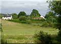
Farmland near Cheddleton, Staffordshire
This telephoto assisted mage was taken from near Spring's Bridge (over the Caldon Canal), looking east across the flood plain of the River Churnet.
Image: © Roger D Kidd
Taken: 1 Aug 2015
0.07 miles
4
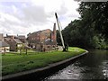
Mill Buildings at Cheddleton, Staffordshire
Image: © Roger D Kidd
Taken: 15 Oct 2007
0.09 miles
5
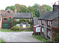
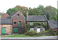
Mill Keepers' Cottages at Cheddleton, Staffordshire
Miller's Cottage opposite is next to the steps leading up to the green doors of the south mill.
Image: © Roger D Kidd
Taken: 15 Oct 2007
0.09 miles
6
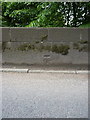
OS benchmark - Cheddleton, Churnet bridge
An OS cutmark in the NW parapet of the bridge over the River Churnet; originally levelled in 1982 at 141.275m above Ordnance Datum Newlyn.
Image: © Richard Law
Taken: 3 Jun 2014
0.09 miles
7
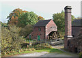
Flint Mill by the Caldon Canal, Cheddleton, Staffordshire
The two mills ground up flint which was brought up from the south of England via sea, river and canal. One of the mills was originally (from the 13th century) a corn mill, but both were utilized as flint mills by the 18th century.
Please see http://www.people.ex.ac.uk/akoutram/cheddleton-mill/about.htm for more details.
Image: © Roger D Kidd
Taken: 15 Oct 2007
0.10 miles
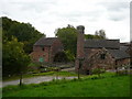
9
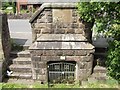
Spring/Well in Cheddleton
This natural spring is on the edge of the recreation ground on Station Road. The notice above the gates states that the water is not fit for drinking.
Image: © Ian Calderwood
Taken: 31 May 2008
0.10 miles
10
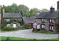
Mill Keepers' Cottages at Cheddleton, Staffordshire
These cottages are below the embanked Caldon Canal. The flint mills are open to visitors.
Image: © Roger D Kidd
Taken: 15 Oct 2007
0.11 miles