IMAGES TAKEN NEAR TO
Dairy Close, LEEK, ST13 6LT
Introduction
This page details the photographs taken nearby to Dairy Close, ST13 6LT by members of the Geograph project.
The Geograph project started in 2005 with the aim of publishing, organising and preserving representative images for every square kilometre of Great Britain, Ireland and the Isle of Man.

There are currently over 7.5m images from over14,400 individuals and you can help contribute to the project by visiting https://www.geograph.org.uk
Image Map (Loading...)


Getting Data...Please wait
Leaflet Map data © OpenStreetMap
Images are licensed for reuse under creativecommons.org/licenses/by-sa/2.0
Notes
- Clicking on the map will re-center to the selected point.
- The higher the marker number, the further away the image location is from the centre of the postcode.
Image Listing (78 Images Found)
Images are licensed for reuse under creativecommons.org/licenses/by-sa/2.0
Image
Details
Distance
1
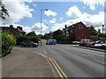
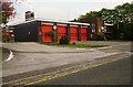
Springfield Road Leek
Springfield Road is a cut through passing a school and the fire station which stops you having to go through the town centre.
Image: © Malcolm Neal
Taken: 17 Aug 2019
0.08 miles
2
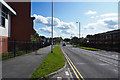
Springfield Road, Leek
Looking south. The supermarket on the right, built by Kwiksave in the 1990s, was later a Somerfield store and a Netto store; it became an Asda supermarket about two years ago.
Image: © David Weston
Taken: 14 Aug 2013
0.08 miles
3
Parker Street, Leek
At the far end is the junction with Ashbourne Road.
Image: © David Weston
Taken: 14 Aug 2013
0.08 miles
4
Parker Street
Off Ashbourne Road, Leek.
Image: © David Lally
Taken: 11 Feb 2010
0.09 miles
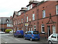
5
The Blue Mugge, Leek
The pub is on the corner of Osborne Street (in shadow) and Queen Street.
Image: © David Weston
Taken: 14 Aug 2013
0.09 miles
6
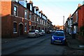
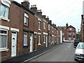
Terraced houses on Queen Street
The design is out of the ordinary for this type of housing.
Image: © Alan Murray-Rust
Taken: 16 May 2011
0.09 miles
7
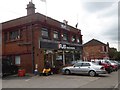
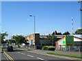
Garden machinery shop, Buxton Road, Leek
Image: © David Smith
Taken: 1 Sep 2017
0.10 miles
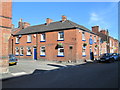
9
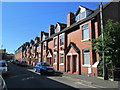
Brunswick Street
Terraced housing from the period of Leek's expansion as a silk town.
Image: © Alan Murray-Rust
Taken: 16 May 2011
0.11 miles