
IMAGES TAKEN NEAR TO
Cheadle Road, STOKE-ON-TRENT, ST10 3AW
Introduction
This page details the photographs taken nearby to Cheadle Road, ST10 3AW by members of the Geograph project.
The Geograph project started in 2005 with the aim of publishing, organising and preserving representative images for every square kilometre of Great Britain, Ireland and the Isle of Man.

There are currently over 7.5m images from over14,400 individuals and you can help contribute to the project by visiting https://www.geograph.org.uk
Image Map
Images are licensed for reuse under creativecommons.org/licenses/by-sa/2.0
Notes
- Clicking on the map will re-center to the selected point.
- The higher the marker number, the further away the image location is from the centre of the postcode.
Image Listing (10 Images Found)
Images are licensed for reuse under creativecommons.org/licenses/by-sa/2.0
Image
Details
Distance
1
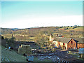
East Wall Farm and Churnet River Valley
A bright winter's day looking north over East Wall farm and the Churnet river valley.
Image: © Chris Brough
Taken: 4 Mar 2006
0.01 miles
2
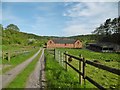
Oakamoor, East Wall Farm
National Trust-tenanted farm next to River Churnet. https://heritagerecords.nationaltrust.org.uk/HBSMR/MonRecord.aspx?uid=MNA142502
Image: © Mike Faherty
Taken: 13 May 2018
0.07 miles
3
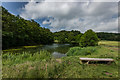
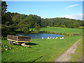
Lake Near Hawksmoor Wood, Staffordshire Way
Lake near East Wall farm, North of Hawksmoor Wood
Image: © Brian Deegan
Taken: 13 Jun 2020
0.07 miles
4
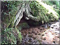
Spring at East Wall
The "Wall" part of the name refers to a spring, but there is no evidence to link it to this particular spring.
Image: © Ian Calderwood
Taken: 15 Aug 2015
0.08 miles
6
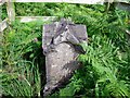
Memorial Stone to Major General W. Reid Martin
The inscription reads, "In memoriam Major General W Reid Martin who died on this spot Dec 31 1892 In the hour of death and in the day of judgement Good Lord deliver us". There seems to be some doubt as to whether he was accidentally shot or died of natural causes.
Image: © Ian Calderwood
Taken: 22 Aug 2015
0.19 miles
7
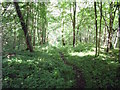
The Gibridding Incline on the Woodhead Tramroad
One of the paths through Gibridding Wood follows part of the line of the Gibridding Incline. An inclined plane was required to let coal wagons down from the valley side to the valley bottom. This incline was probably self-acting, in which the descending loaded wagons are linked to ascending empties by a continuous rope or chain, controlled by a brake. The loaded wagons, with their greater weight, thus, pull the empties up as they descend.
Image: © Ian Calderwood
Taken: 15 Aug 2015
0.20 miles
8
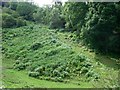
Steep track at the edge of Gibridding Wood
Image: © Ian Calderwood
Taken: 22 Aug 2015
0.22 miles
9
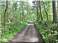
Oakamoor, woodland road
Through Hawksmoor Wood towards East Wall Farm and River Churnet; in the National Trust's Hawksmoor, and on Staffordshire Moorlands Walks.
Image: © Mike Faherty
Taken: 13 May 2018
0.23 miles
10

The Churnet valley west of Oakamoor
A study in green and gold.
Image: © Christine Johnstone
Taken: 27 May 2012
0.24 miles