
IMAGES TAKEN NEAR TO
Stoneydale, STOKE-ON-TRENT, ST10 3AH
Introduction
This page details the photographs taken nearby to Stoneydale, ST10 3AH by members of the Geograph project.
The Geograph project started in 2005 with the aim of publishing, organising and preserving representative images for every square kilometre of Great Britain, Ireland and the Isle of Man.

There are currently over 7.5m images from over14,400 individuals and you can help contribute to the project by visiting https://www.geograph.org.uk
Image Map
Images are licensed for reuse under creativecommons.org/licenses/by-sa/2.0
Notes
- Clicking on the map will re-center to the selected point.
- The higher the marker number, the further away the image location is from the centre of the postcode.
Image Listing (11 Images Found)
Images are licensed for reuse under creativecommons.org/licenses/by-sa/2.0
Image
Details
Distance
1
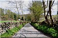
The final run down Stoney Dale to The Churnet Valley
The journey from Threapwood to the Churnet Valley, along Chapel Lane and Stoney Dale, is one of the most interesting narrow lanes that I have ever been along.
Image: © Mick Malpass
Taken: 14 Apr 2012
0.01 miles
2
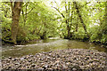
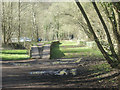
River Churnet at Oakamoor
Looking downstream from a point just after the channelled section
Image: © Gary Rogers
Taken: 28 May 2009
0.16 miles
3

River Churnet at Oakamoor
Looking upstream to the channelled section
Image: © Gary Rogers
Taken: 28 May 2009
0.16 miles
4
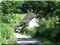
Far Stoney Dale Cottages
Stoney Dale used to be the main road out of Oakamoor towards Cheadle until the turnpike road was built in 1762.
Image: © Ian Calderwood
Taken: 21 Jun 2015
0.18 miles
6

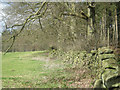
Oakamoor railway station (site), Staffordshire
Opened in 1849 by the North Staffordshire Railway on the line from Uttoxeter to Leek and Macclesfield, this station closed in 1965 . It was demolished in the 1970s after an arson attack.
View northwest towards Kingsley & Froghall and Leek on the heritage Churnet Valley Railway, who aspire to reinstate the track back to Oakamoor one day.
Image: © Nigel Thompson
Taken: 26 Apr 2025
0.19 miles
7
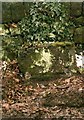
Old Milestone by the B5417, Church Bank, Oakamoor
Stone post (plate lost) by the B5417, in parish of Oakamoor (Staffordshire Moorlands District), Church Bank, on the verge in front of stone wall, on South side of road, in front of 'Lower Croft'. Cheadle iron plate, erected by the Cheadle to Butterton Moor (District of Cheadle) turnpike trust in the 19th century.
Inscription once read:-
(CHEADLE)
(3)
Staffordshire HER.
HER Number: 51279 https://www.heritagegateway.org.uk/Gateway/Results_Single.aspx?uid=MST12499&resourceID=1010
Milestone Society National ID: ST_CDBM03
Image: © J Higgins
Taken: 1 Jan 2001
0.19 miles
9
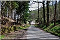
Out of the Trees to Civilization
Heading towards Oakamoor.
Image: © Mick Malpass
Taken: 14 Apr 2012
0.21 miles
10
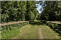
Oakamoor Station, Churnet Valley Line (Closed 1965)
The station was opened in 1849 as part of the Churnet Valley Line constructed by the North Staffordshire Railway. Serving the village of Oakamoor the station remained open until 1965 when all services were withdrawn.
Churnet Valley Wiki >>> https://en.wikipedia.org/wiki/Churnet_Valley_line
Oakamoor Station Wiki >>> https://en.wikipedia.org/wiki/Oakamoor_railway_station
Image: © Brian Deegan
Taken: 28 May 2020
0.21 miles