
IMAGES TAKEN NEAR TO
Hernen Road, CANVEY ISLAND, SS8 8BT
Introduction
This page details the photographs taken nearby to Hernen Road, SS8 8BT by members of the Geograph project.
The Geograph project started in 2005 with the aim of publishing, organising and preserving representative images for every square kilometre of Great Britain, Ireland and the Isle of Man.

There are currently over 7.5m images from over14,400 individuals and you can help contribute to the project by visiting https://www.geograph.org.uk
Image Map
Images are licensed for reuse under creativecommons.org/licenses/by-sa/2.0
Notes
- Clicking on the map will re-center to the selected point.
- The higher the marker number, the further away the image location is from the centre of the postcode.
Image Listing (12 Images Found)
Images are licensed for reuse under creativecommons.org/licenses/by-sa/2.0
Image
Details
Distance
1
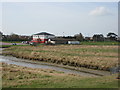
Canvey Rugby Club
Between Dovervelt Road and the sea wall.
Image: © Ron Galliers
Taken: 17 Mar 2009
0.12 miles
3
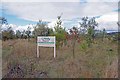
Creeky Wood
This new wood on Canvey Island was planted with many native species in 2008/9 with the help of local volunteers.
Image: © Glyn Baker
Taken: 9 Oct 2016
0.15 miles
4
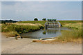
Flood control infrastructure, Tewkes Creek, Canvey Island
Image: © David Kemp
Taken: 21 Jul 2018
0.18 miles
5
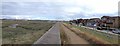
Sunken Marsh
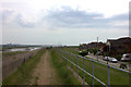
This view along the sea wall shows how vulnerable Canvey Island would be to flooding if the sea defences were neglected. you can see the road is considerably lower than the salt marsh.
Image: © Glyn Baker
Taken: 9 Oct 2016
0.21 miles
7
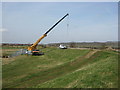
Drainage Repairs
Constant attention to flood defences is vital to Canvey remaining dry.
Image: © Ron Galliers
Taken: 17 Mar 2009
0.21 miles
8
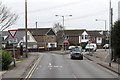
B1014, Canvey Island
The Junction of Central Wall Road with Elder Tree Road (on the left) and Knightswick Road. This junction marks the northern end of a one-way system in the centre of Canvey Island.
Image: © Martin Addison
Taken: 2 Mar 2013
0.23 miles
9
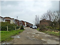
Rough connection between roads, Canvey Island
Kellington Road and Nevada Road, ahead, appear to have been developed separately, and only this rough and ready bit of track connects them.
Image: © Robin Webster
Taken: 25 Mar 2018
0.24 miles
10
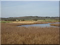
Golf course obstacle
Lake at the eastern end of Canvey golf course. With views toward Benfleet Downs and the water tower.
Image: © Ron Galliers
Taken: 17 Mar 2009
0.24 miles