
IMAGES TAKEN NEAR TO
Mornington Road, CANVEY ISLAND, SS8 8AT
Introduction
This page details the photographs taken nearby to Mornington Road, SS8 8AT by members of the Geograph project.
The Geograph project started in 2005 with the aim of publishing, organising and preserving representative images for every square kilometre of Great Britain, Ireland and the Isle of Man.

There are currently over 7.5m images from over14,400 individuals and you can help contribute to the project by visiting https://www.geograph.org.uk
Image Map
Images are licensed for reuse under creativecommons.org/licenses/by-sa/2.0
Notes
- Clicking on the map will re-center to the selected point.
- The higher the marker number, the further away the image location is from the centre of the postcode.
Image Listing (5 Images Found)
Images are licensed for reuse under creativecommons.org/licenses/by-sa/2.0
Image
Details
Distance
1
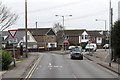
B1014, Canvey Island
The Junction of Central Wall Road with Elder Tree Road (on the left) and Knightswick Road. This junction marks the northern end of a one-way system in the centre of Canvey Island.
Image: © Martin Addison
Taken: 2 Mar 2013
0.19 miles
2
High Street Canvey
Looking east towards Leigh Beck.
Image: © Ron Galliers
Taken: 13 Feb 2005
0.22 miles
3
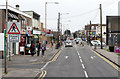
High Street Canvey
Seen from a coach passing through. There are few pedestrians at lunchtime on a Saturday but a steady stream of cars.
Image: © Martin Addison
Taken: 2 Mar 2013
0.22 miles
4
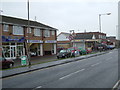
High St Canvey
The photo was taken from the south side of the High St Looking eastward.
Image: © Glyn Baker
Taken: 16 Jan 2006
0.23 miles
5
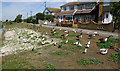
Bird feeding area, Canvey Lake
A variety of birds are to be found on and around Canvey Lake. Identifiable in this avian assemblage are Canada geese, mallards, coots, moorhens, black-headed gulls and a pigeon.
Image: © David Kemp
Taken: 11 Aug 2018
0.24 miles