
IMAGES TAKEN NEAR TO
High Road, BENFLEET, SS7 5HL
Introduction
This page details the photographs taken nearby to High Road, SS7 5HL by members of the Geograph project.
The Geograph project started in 2005 with the aim of publishing, organising and preserving representative images for every square kilometre of Great Britain, Ireland and the Isle of Man.

There are currently over 7.5m images from over14,400 individuals and you can help contribute to the project by visiting https://www.geograph.org.uk
Image Map
Images are licensed for reuse under creativecommons.org/licenses/by-sa/2.0
Notes
- Clicking on the map will re-center to the selected point.
- The higher the marker number, the further away the image location is from the centre of the postcode.
Image Listing (10 Images Found)
Images are licensed for reuse under creativecommons.org/licenses/by-sa/2.0
Image
Details
Distance
1
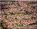
Aerial view of Hopes Green south of Benfleet High Road
Benfleet High Road runs across, just above centre, from left to right. There is a bus visible. The houses below this (south) are part of the Hopes Green estate. The road across the bottom left corner is Benfleet Park Road. The roads below and parallel to the High Road are Richmond Avenue and Merrivale.
Image: © Edward Clack
Taken: 17 Jun 1987
0.08 miles
2
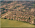
Aerial view of Cemetery Corner and Hopes Green, Benfleet
Cemetery Corner is an important marker in Benfleet, where the High Road does a sharp right-angle. The cemetery can be seen, surrounded by trees, at just above centre-left Image One branch of the High Road is hidden behind the trees, the other runs from the corner to the top right. The road running down and left from the corner (just visible) is Jotman's Lane, which today leads underneath the Canvey Way (A130) Image The main bulk of the houses here are part of the Hopes Green estate.
Image: © Edward Clack
Taken: 17 Jun 1987
0.10 miles
3
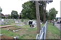
Cemetery, Cemetery Corner, Benfleet
The cemetery is at "Cemetery Corner", which is the junction of Benfleet High Road and Jotmans Lane.
Image: © Trevor Harris
Taken: 26 Aug 2008
0.10 miles
4
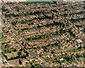
Aerial view of Benfleet cemetery corner, looking north-west
Cemetery Corner is the bend in the Benfleet High Road which here runs from the upper left to the lower right. The cemetery can clearly be seen to the left of the bend. The road running to the lower left from the corner is Jotman's Lane. That running to the lower centre is Benfleet Park Road. The group of houses on the curve, below the High Road on the right were, at the time, some of the few council houses in the area.
Image: © Edward Clack
Taken: 1 Jul 1987
0.11 miles
5
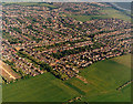
Aerial view of south-western Benfleet
This wide view shows most of the south-western corner of Benfleet. The High Road runs from mid-left sloping upwards to the cemetery, just right of centre, then turns left and up. The road with houses off the High Road at the left is Limetree Avenue. The building plot to its left will become Chestnut Grove. The open area in the upper right is the Hopes Green Recreation Area, with Benfleet Creek at the top right.
Image: © Edward Clack
Taken: 20 May 1987
0.14 miles
6
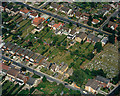
Aerial view of the High Road, Elm View Road and Benfleet Cemetery
Elm View Road runs across the lower left, and the High Road across the upper right. The cemetery lie to the lower centre-left.
Image: © Edward Clack
Taken: 13 Jun 1988
0.17 miles
7
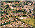
Aerial view of Hopes Green south of Benfleet High Road
This photo is of an area just east of Image Benfleet High Road runs above centre, with Richmond Avenue below centre. Near the right, Richmond Avenue turns north (up) to the High Road, with the Appleton Arms pub on the corner. The green area to the lower right is part of the Hopes Green Recreation Area.
Image: © Edward Clack
Taken: 17 Jun 1987
0.19 miles
8
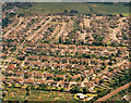
Aerial view of the Hopes Green estate, Benfleet
This photo shows almost all of the Hopes Green estate, apart from the northernmost third, and the south-west corner known as the 'Bird' estate Image In the foreground are allotments. In the background, the green is part of the Hopes Green recreation ground. The railway, from Southend and Benfleet to Fenchurch Street is visible in the bottom left corner.
Image: © Edward Clack
Taken: 17 Jun 1987
0.21 miles
9
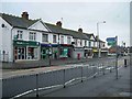
High Rd Benfleet
This parade of shops is on the B1006 High Rd Benfleet
Image: © Glyn Baker
Taken: 1 Jan 2006
0.23 miles
10
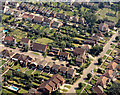
Aerial view of Jotman's Lane and the Cemetery, Benfleet
Jotman's Lane runs obliquely across the bottom right corner. The cemetery is at the top right. The two roads joining Jotman's Lane are (from the bottom) Uplands Road and Elm View Road.
Image: © Edward Clack
Taken: 3 Aug 1987
0.23 miles