Aerial view of Cemetery Corner and Hopes Green, Benfleet
Introduction
The photograph on this page of Aerial view of Cemetery Corner and Hopes Green, Benfleet by Edward Clack as part of the Geograph project.
The Geograph project started in 2005 with the aim of publishing, organising and preserving representative images for every square kilometre of Great Britain, Ireland and the Isle of Man.

There are currently over 7.5m images from over 14,400 individuals and you can help contribute to the project by visiting https://www.geograph.org.uk
Aerial view of Cemetery Corner and Hopes Green, Benfleet
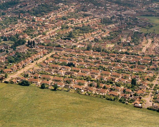
Image: © Edward Clack Taken: 17 Jun 1987
Cemetery Corner is an important marker in Benfleet, where the High Road does a sharp right-angle. The cemetery can be seen, surrounded by trees, at just above centre-left Image One branch of the High Road is hidden behind the trees, the other runs from the corner to the top right. The road running down and left from the corner (just visible) is Jotman's Lane, which today leads underneath the Canvey Way (A130) Image The main bulk of the houses here are part of the Hopes Green estate.
Images are licensed for reuse under creativecommons.org/licenses/by-sa/2.0
Image Location
Latitude
51.554117
Longitude
0.551711