
IMAGES TAKEN NEAR TO
Lambeth Road, BENFLEET, SS7 4BN
Introduction
This page details the photographs taken nearby to Lambeth Road, SS7 4BN by members of the Geograph project.
The Geograph project started in 2005 with the aim of publishing, organising and preserving representative images for every square kilometre of Great Britain, Ireland and the Isle of Man.

There are currently over 7.5m images from over14,400 individuals and you can help contribute to the project by visiting https://www.geograph.org.uk
Image Map
Images are licensed for reuse under creativecommons.org/licenses/by-sa/2.0
Notes
- Clicking on the map will re-center to the selected point.
- The higher the marker number, the further away the image location is from the centre of the postcode.
Image Listing (29 Images Found)
Images are licensed for reuse under creativecommons.org/licenses/by-sa/2.0
Image
Details
Distance
2
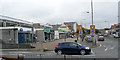
Shops at the Tarpots road junction
This parade of shops is on the northern side of the London Road (A13), opposite those seen in Image
Image: © John Rostron
Taken: 7 Oct 2009
0.07 miles
3
Church Road, New Thundersley
Here is the same spot. https://www.geograph.org.uk/photo/6550175
Image: © David Howard
Taken: 25 May 2021
0.08 miles
5
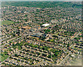
Wide view of the Great Tarpots area
This view shows much of squares Image and Image beyond it. The road running from the lower left of centre to the upper right is the A13 or London Road. The Tarpots junction lies in the centre.
Image: © Edward Clack
Taken: 8 May 1987
0.09 miles
6
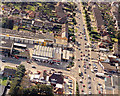
Aerial view of Great Tarpots from the east
The road running from top to bottom is the A13 (London Road). The road to the left is the B1006 (High Road). To the lower centre is the Harvester pub Image Across the High Road from this is a group of shops then known as Shaeffer's Arcade. This, and the garage on the corner have now gone, and on the corner there is now a Tesco Express.
Image: © Edward Clack
Taken: 18 Sep 1987
0.11 miles
7
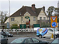
Harvester pub with Tarpot
This pub was once known as 'The Tarpot'. The area, in the 15th century, was known as 'Tarpottys', and ultimately gave its name to the pub once it was built. It has since been taken over by the Harvester chain, but still retains the old tar pot at the corner.
Image: © John Rostron
Taken: 7 Oct 2009
0.11 miles
8
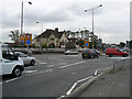
The Tarpots road junction and pub
Tarpots is the first of several mini-roundabouts on the A13 (London Rd) for a driver entering Benfleet. It is named after the pub on the corner, visible in the centre. The pub sports an old tarpot (supposed) over the entrance (facing the camera).
Image: © John Rostron
Taken: 30 Sep 2009
0.11 miles
9
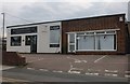
MSB Accountants on Rushbottom Road, Thundersley
Image: © David Howard
Taken: 26 Jul 2020
0.12 miles
10
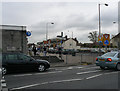
Shops at the Tarpots road junction
Benfleet is odd in that it does not really have a town centre. Tarpots is one of several shopping areas. It has many shops, two banks, a solicitors and a pub. The parade of shops opposite can be seen in Image
Image: © John Rostron
Taken: 30 Sep 2009
0.12 miles