Aerial view of Great Tarpots from the east
Introduction
The photograph on this page of Aerial view of Great Tarpots from the east by Edward Clack as part of the Geograph project.
The Geograph project started in 2005 with the aim of publishing, organising and preserving representative images for every square kilometre of Great Britain, Ireland and the Isle of Man.

There are currently over 7.5m images from over 14,400 individuals and you can help contribute to the project by visiting https://www.geograph.org.uk
Aerial view of Great Tarpots from the east
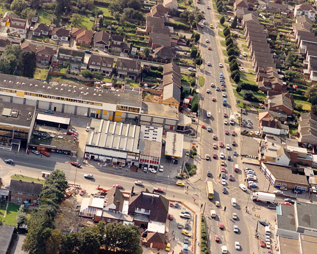
Image: © Edward Clack Taken: 18 Sep 1987
The road running from top to bottom is the A13 (London Road). The road to the left is the B1006 (High Road). To the lower centre is the Harvester pub Image Across the High Road from this is a group of shops then known as Shaeffer's Arcade. This, and the garage on the corner have now gone, and on the corner there is now a Tesco Express.
Images are licensed for reuse under creativecommons.org/licenses/by-sa/2.0
Image Location
Latitude
51.567455
Longitude
0.550437