
IMAGES TAKEN NEAR TO
Thirlmere Road, BENFLEET, SS7 3HY
Introduction
This page details the photographs taken nearby to Thirlmere Road, SS7 3HY by members of the Geograph project.
The Geograph project started in 2005 with the aim of publishing, organising and preserving representative images for every square kilometre of Great Britain, Ireland and the Isle of Man.

There are currently over 7.5m images from over14,400 individuals and you can help contribute to the project by visiting https://www.geograph.org.uk
Image Map
Images are licensed for reuse under creativecommons.org/licenses/by-sa/2.0
Notes
- Clicking on the map will re-center to the selected point.
- The higher the marker number, the further away the image location is from the centre of the postcode.
Image Listing (7 Images Found)
Images are licensed for reuse under creativecommons.org/licenses/by-sa/2.0
Image
Details
Distance
1
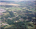
Aerial view of Thundersley Plotlands Lake District
This area of plotlands is known as the 'Lake District' because many of the roads are named after Cumbrian lakes. Bassenthwaite Road runs from just above the lower left corner to a point below the centre. Keswick Road runs above and parallel to this up to a group of houses below-left of centre. Here it meets Windermere Road which runs down to the lower right, and also runs left, then turns to run to the right. Coniston Road runs from Windermere Road (between the junctions with Keswick Road and Bassenthwaite Road) to the centre left (and parallel with Windermere Road). The patch of woodland between Keswick Road and Bassenthwaite Road includes the Thundersley Oaks nature conservation area Image
Image: © Edward Clack
Taken: 3 Aug 1987
0.11 miles
2

Thundersley pond before filling
When we first moved to Thundersley in 1975, this pond was small and choked. In 1985, the council decided to excavate a newer, larger one. Here, the excavations have finished, and the pond is beginning to fill. Image shows it after filling.
Image: © John Rostron
Taken: Unknown
0.12 miles
3
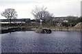
Thundersley pond after filling
This was taken in early 1986, when the pond had filled, and settled down. Over the next few years, it became a fine wildlife pond with abundant dragonflies. Image shows it before filling.
Image: © John Rostron
Taken: Unknown
0.13 miles
4

A Thundersley Oak
Given another 400 years this will be a proper oak tree! The nest box was provided by Essex Wildlife Trust http://www.essexwt.org.uk/ who manage this small nature reserve Image Continue on a virtual tour of Wildlife Trust Reserves in Essex by visiting Image
Image: © Glyn Baker
Taken: 25 Aug 2009
0.18 miles
5
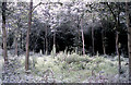
Thundersley Oaks Nature Conservation Area
Thundersley Oaks is a small area of Essex plotland in Bassenthwaite Rd, owned by the Essex Wildlife Trust http://www.essexwt.org.uk/ . Much of the surrounding plotland is either built on, totally neglected or is used for horse grazing. Thundersley Oaks is receiving a modest amount of management to preserve a good vegetation understorey.
Image: © John Rostron
Taken: Unknown
0.18 miles
6
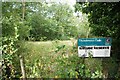
Thundersley Oaks
Thundersley Oaks is one of the smaller Essex Wildlife Trust Reserves http://www.essexwt.org.uk/ , its existence is not advertised much as too many visitors would damage the flora and probably annoy the neighbours! The trees seem to be more established than in John Rostron’s 1983 photo Image were there is some more info on the reserve. See also Image Continue on a virtual tour of Wildlife Trust Reserves in Essex
by visiting Image
Image: © Glyn Baker
Taken: 25 Aug 2009
0.20 miles
7
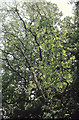
Wild Service Tree in Thundersley Plotlands
The Wild Service Tree is typical of the Ancient Woodlands in south-eastern England. However some trees do persist in areas that were once such woodland. This tree is near to Thundersley Church Grove, a possibly ancient woodland, but on the edge of a patch of secondary woodland. I photographed this tree because it is unusual to find one growing as a standard, half in the open. This one was around 20m tall.
Image: © John Rostron
Taken: Unknown
0.23 miles