
IMAGES TAKEN NEAR TO
Castle Lane, BENFLEET, SS7 2AL
Introduction
This page details the photographs taken nearby to Castle Lane, SS7 2AL by members of the Geograph project.
The Geograph project started in 2005 with the aim of publishing, organising and preserving representative images for every square kilometre of Great Britain, Ireland and the Isle of Man.

There are currently over 7.5m images from over14,400 individuals and you can help contribute to the project by visiting https://www.geograph.org.uk
Image Map
Images are licensed for reuse under creativecommons.org/licenses/by-sa/2.0
Notes
- Clicking on the map will re-center to the selected point.
- The higher the marker number, the further away the image location is from the centre of the postcode.
Image Listing (49 Images Found)
Images are licensed for reuse under creativecommons.org/licenses/by-sa/2.0
Image
Details
Distance
1
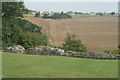
View of the rear of houses on Castle Road from Hadleigh Castle
Looking north-northeast.
Image: © Robert Lamb
Taken: 23 Aug 2015
0.10 miles
2
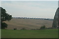
View of the backs of houses on Tattersall Gardens from Hadleigh Castle
Looking south-southeast.
Image: © Robert Lamb
Taken: 23 Aug 2015
0.11 miles
3
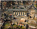
Aerial view of Hadleigh light industrial area
This shows the light industrial area between the London Road (A13) at the upper right, and Beech Road running along the left side. At the top right, on either side of the London Road are the Castle Pub (left) and the Ancora restaurant (right). Both are worth a visit.
Image: © Edward Clack
Taken: 16 Oct 1987
0.11 miles
4
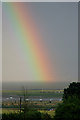
Rainbow over the Thames Estuary
Taken from Hadleigh, this lovely rainbow appeared to be in the middle of the Thames Estuary. In the foreground is Benfleet creek and Canvey-Leigh-Beck.
Behind and to the left of the rainbow is the entrance to the river Medway.
The area of Kent to the right is known (I believe) as the Isle of Grain.
Image: © gary faux
Taken: 7 Jul 2008
0.14 miles
5
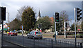
Hadleigh, Essex
This photo is of the eastern end of the dual carriageway, where the A13 (London Road) splits. The traffic lights control a pedestrian crossing and traffic coming from the north. In the background is Hadleigh Church (St James the Less).
Image: © John Rostron
Taken: 19 Feb 2010
0.16 miles
7
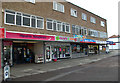
Shops at Hadleigh
These shops are on the southern side of the London Road (A13) just to the east of where splits either side of Hadleigh Church Image
Image: © John Rostron
Taken: 19 Feb 2010
0.16 miles
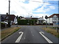
10
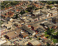
Aerial view of east Hadleigh, London Road
This shows the London Road east of the Hadleigh main centre. There are a number of shops, offices and light industry along this stretch.
Image: © Edward Clack
Taken: 11 Sep 1987
0.17 miles