IMAGES TAKEN NEAR TO
London Road, RAYLEIGH, SS6 9JD
Introduction
This page details the photographs taken nearby to London Road, SS6 9JD by members of the Geograph project.
The Geograph project started in 2005 with the aim of publishing, organising and preserving representative images for every square kilometre of Great Britain, Ireland and the Isle of Man.

There are currently over 7.5m images from over14,400 individuals and you can help contribute to the project by visiting https://www.geograph.org.uk
Image Map
Images are licensed for reuse under creativecommons.org/licenses/by-sa/2.0
Notes
- Clicking on the map will re-center to the selected point.
- The higher the marker number, the further away the image location is from the centre of the postcode.
Image Listing (19 Images Found)
Images are licensed for reuse under creativecommons.org/licenses/by-sa/2.0
Image
Details
Distance
1
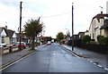
Kenilworth Gardens
Pedestrians use this road to get to Station Avenue and beyond by a footpath.
Image: © terry joyce
Taken: 19 Oct 2010
0.06 miles
2
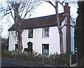
Pearsons Farm, Rayleigh
Pearsons Farm house. Boarded house on the A129 Rayleigh-Wickford road. The farm is long gone, submerged under 50-60's housing to both the north and the south of the main road
Image: © John Myers
Taken: 21 Jan 2007
0.09 miles
3

Two Windmills
The grid reference is for the Wind Turbine.
I took the picture from Sweyne Park to show Rayleigh's two Windmills.
You can also see Holy Trinity Church in Rayleigh High Street.
Image: © terry joyce
Taken: 15 Oct 2007
0.14 miles
4
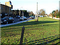
The A129 London Road
This is a section of the A129 London Road in Rayleigh, it allows traffic to enter and leave Rayleigh via the A1245. The post in the foreground is an Essex County Council Boundary Post. Its purpose is not known. There are around six of these in the vicinity. They are black on this side of the road and green on the other side.
Image: © terry joyce
Taken: 9 Jan 2011
0.16 miles
5
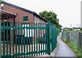
Scout Hut
This is the hut of the 1st Rayleigh Scouts. The pathway links Image with Station Avenue.
Image: © terry joyce
Taken: 19 Oct 2010
0.17 miles
6
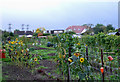
Kenilworth Gardens Allotment
Access to this Allotment is by the pathway that links Kenilworth Gardens with Station Avenue.
Image: © terry joyce
Taken: 19 Oct 2010
0.18 miles
7
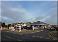
Tesco Express
Opened on 17th February 2012. The property is located on the London Road (A129) and Vernon Avenue in Rayleigh. Construction started towards the end of 2011. An Offlicence which was on the site before was demolished.
Image: © terry joyce
Taken: 17 Feb 2012
0.19 miles
8
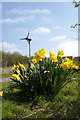
Wind Turbine, Sweyne Park
This wind turbine appears to be in the garden of a domestic dwelling backing on to Sweyne Park near Rayleigh. Daffs in the foreground are clearly of a cultivated variety. Image are much smaller.
Image: © Glyn Baker
Taken: 22 Apr 2006
0.19 miles
9
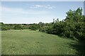
Sweyne Park Open Space, Rayleigh
Sweyne Park Open Space is managed by Rochford District Council: https://www.rochford.gov.uk/leisure-and-tourism/woodlands-parks-and-open-spaces/sweyne-park-open-space
They say:
"The area currently known as Sweyne Park Open Space was originally war time agricultural land, after which it continued in agricultural tenancy until transferred from the Ministry of Agriculture to Rochford District Council in the late 1980's...
The park is approximately 57 acres in size, with 2 kilometres of pathways and 4 Kilometres of hedging"
Image: © Roger Jones
Taken: 19 May 2022
0.20 miles