
IMAGES TAKEN NEAR TO
Langdon Road, RAYLEIGH, SS6 9HY
Introduction
This page details the photographs taken nearby to Langdon Road, SS6 9HY by members of the Geograph project.
The Geograph project started in 2005 with the aim of publishing, organising and preserving representative images for every square kilometre of Great Britain, Ireland and the Isle of Man.

There are currently over 7.5m images from over14,400 individuals and you can help contribute to the project by visiting https://www.geograph.org.uk
Image Map
Images are licensed for reuse under creativecommons.org/licenses/by-sa/2.0
Notes
- Clicking on the map will re-center to the selected point.
- The higher the marker number, the further away the image location is from the centre of the postcode.
Image Listing (9 Images Found)
Images are licensed for reuse under creativecommons.org/licenses/by-sa/2.0
Image
Details
Distance
1
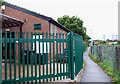
Scout Hut
This is the hut of the 1st Rayleigh Scouts. The pathway links Image with Station Avenue.
Image: © terry joyce
Taken: 19 Oct 2010
0.06 miles
2
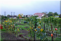
Kenilworth Gardens Allotment
Access to this Allotment is by the pathway that links Kenilworth Gardens with Station Avenue.
Image: © terry joyce
Taken: 19 Oct 2010
0.06 miles
3
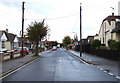
Kenilworth Gardens
Pedestrians use this road to get to Station Avenue and beyond by a footpath.
Image: © terry joyce
Taken: 19 Oct 2010
0.08 miles
4
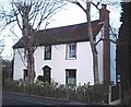
Pearsons Farm, Rayleigh
Pearsons Farm house. Boarded house on the A129 Rayleigh-Wickford road. The farm is long gone, submerged under 50-60's housing to both the north and the south of the main road
Image: © John Myers
Taken: 21 Jan 2007
0.13 miles
5
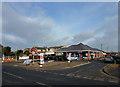
Tesco Express
Opened on 17th February 2012. The property is located on the London Road (A129) and Vernon Avenue in Rayleigh. Construction started towards the end of 2011. An Offlicence which was on the site before was demolished.
Image: © terry joyce
Taken: 17 Feb 2012
0.18 miles
6
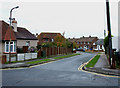
Station Avenue
This road is very close to the back entrance of Rayleigh railway station.
Image: © terry joyce
Taken: 28 Oct 2010
0.21 miles
7
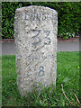
Old Milestone by the A129, London Road, Rayleigh
Carved stone post by the A129, in parish of RAYLEIGH (ROCHFORD District), London Road, just East of junction with Victoria Avenue, on verge in front of path, on North side of road, adjacent to two utility boxes. Erected by the Rochford Hundred (Div of Essex First Dist) turnpike trust in the 19th century.
Inscription reads:-
LONDON
33
SOUTHEND
8
MILES
Essex HER listed.
SMR Number: 40240 https://www.heritagegateway.org.uk/Gateway/Results_Single.aspx?uid=MEX1034182&resourceID=1001
Milestone Society National ID: EX_BWRY33.
Image: © JV Nicholls
Taken: Unknown
0.23 miles
8
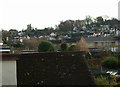
Rooftop View
Taken from the roof of a 1930's bungalow looking at the more modern houses in Rayleigh. The Church and Windmill can be seen in the background.
Image: © terry joyce
Taken: 20 Dec 2011
0.24 miles
9
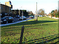
The A129 London Road
This is a section of the A129 London Road in Rayleigh, it allows traffic to enter and leave Rayleigh via the A1245. The post in the foreground is an Essex County Council Boundary Post. Its purpose is not known. There are around six of these in the vicinity. They are black on this side of the road and green on the other side.
Image: © terry joyce
Taken: 9 Jan 2011
0.24 miles