
IMAGES TAKEN NEAR TO
Totman Close, RAYLEIGH, SS6 7UZ
Introduction
This page details the photographs taken nearby to Totman Close, SS6 7UZ by members of the Geograph project.
The Geograph project started in 2005 with the aim of publishing, organising and preserving representative images for every square kilometre of Great Britain, Ireland and the Isle of Man.

There are currently over 7.5m images from over14,400 individuals and you can help contribute to the project by visiting https://www.geograph.org.uk
Image Map
Images are licensed for reuse under creativecommons.org/licenses/by-sa/2.0
Notes
- Clicking on the map will re-center to the selected point.
- The higher the marker number, the further away the image location is from the centre of the postcode.
Image Listing (10 Images Found)
Images are licensed for reuse under creativecommons.org/licenses/by-sa/2.0
Image
Details
Distance
1
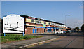
Brook Road Industrial Estate
This is the start of Rayleigh's Brook Road Industrial Estate.
Two of Rayleigh's main Leisure Activity Centres are based here.
Just behind the sign is Megazone, a Laser Arena. http://www.rayleighmegazone.co.uk/
Just past the Megazone is Rayleigh Karting, an indoor Go Kart Arena.
http://www.essexkarting.co.uk/
Image: © terry joyce
Taken: 1 Nov 2007
0.11 miles
3
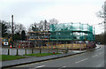
New development
They knocked down a bungalow in Weir Gardens and now they are filling every inch of the plot with whatever this is. At the bottom of Weir Gardens. The road in the foreground is Brook Road.
Image: © terry joyce
Taken: 11 Feb 2011
0.16 miles
4
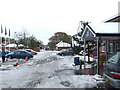
Premier Inn
This is the car park and entrance to the Premier Inn at Rayleigh Weir.
Image: © terry joyce
Taken: 4 Dec 2010
0.18 miles
5
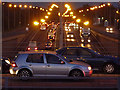
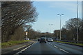
Southend Arterial Road
Looking along the A127 towards Southend from the elevated roundabout at Rayleigh Weir.
Image: © John Allan
Taken: 25 Oct 2010
0.19 miles
6
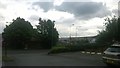
Car park and retail sites, Rayleigh Weir
Typical edge-city scenery here at Rayleigh Weir: from the car park of a motel, one looks across the hidden A127 to "big shed" retail architecture.
Image: © Christopher Hilton
Taken: 24 Jun 2017
0.20 miles
7
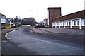
Brook Road Industrial Estate, Rayleigh
Industrial estate east of the Weir and north of the A127.
Image: © John Myers
Taken: 24 Dec 2006
0.20 miles
8
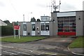
Rayleigh Fire Station
This fire station is soon to be replaced by a new one currently being built on Stadium Way Trading Estate, Rayleigh Weir.
Image: © Trevor Harris
Taken: 21 Aug 2008
0.23 miles
9
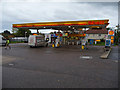
Shell Service Station, Rayleigh Weir
The station is on the A129, just north of its junction with the A127 Southend Arterial Road.
Image: © John Allan
Taken: 27 Oct 2010
0.24 miles
10
Gas tank at the petrol station on High Road, Weir
Image: © David Howard
Taken: 8 Apr 2019
0.25 miles