
IMAGES TAKEN NEAR TO
Glencrofts, HOCKLEY, SS5 4GN
Introduction
This page details the photographs taken nearby to Glencrofts, SS5 4GN by members of the Geograph project.
The Geograph project started in 2005 with the aim of publishing, organising and preserving representative images for every square kilometre of Great Britain, Ireland and the Isle of Man.

There are currently over 7.5m images from over14,400 individuals and you can help contribute to the project by visiting https://www.geograph.org.uk
Image Map
Images are licensed for reuse under creativecommons.org/licenses/by-sa/2.0
Notes
- Clicking on the map will re-center to the selected point.
- The higher the marker number, the further away the image location is from the centre of the postcode.
Image Listing (18 Images Found)
Images are licensed for reuse under creativecommons.org/licenses/by-sa/2.0
Image
Details
Distance
1
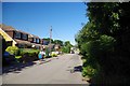
White Hart Lane, Hawkwell
No footie here!
Image: © Glyn Baker
Taken: 26 Aug 2013
0.04 miles
2
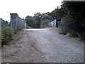
Railway bridge - White Hart Lane
Byway beside railway between Hockley and Rectory Road. Signed as "Unsuitable for motor vehicles" but track maintenance crews get lorries through it!
Image: © John Myers
Taken: 12 Feb 2005
0.06 miles
3
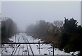
Snowy Railway
Taken from the Image in White Hart Lane. This is the London Liverpool Street to Southend Victoria railway looking towards Hockley.
Image: © terry joyce
Taken: 6 Dec 2010
0.07 miles
4
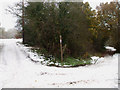
Decisions Decisions
Which way to go? The left fork goes over the Image in White Hart Lane.
The post is marked as a bridleway and part of Roach Valley Way. A 23 mile walk.
See http://www.essex.gov.uk/Travel-Highways/Public-Rights-Way/Documents/The_Roach_Valley_Way_A5.pdf an Essex County Council information sheet
The right fork is another bridleway.
Image: © terry joyce
Taken: 6 Dec 2010
0.07 miles
5
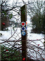
Bridleway Marker
This marker identifies two bridleways one of which is part of the Roach Valley Way.
See Image to see its surroundings and for more information..
Image: © terry joyce
Taken: 6 Dec 2010
0.07 miles
6
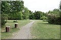
Glencroft Open Space, Hawkwell
Glencroft Open Space is managed by Hawkwell Parish Council.
Image: © Roger Jones
Taken: 18 May 2022
0.08 miles
7
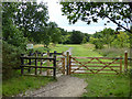
Glencroft Open Space
A Hawkwell Parish Council amenity, owned by the Rochford District Council and with a 125 year lease to the parish council at a peppercorn rent. The mysteries of local government! It was formerly Glencroft Nurseries land, transferred to the council as a condition of granting planning permission for housing development on the rest of the nursery site.
Image: © Robin Webster
Taken: 30 Jul 2017
0.08 miles
8
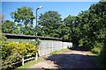
Hawkwell Scout Hut
I am not sure if the Scout hut is at the end of White Hart Lane or the beginning of Magnolia Rd.
Image: © Glyn Baker
Taken: 26 Aug 2013
0.08 miles
9
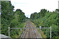
Southend Victoria line
Looking in the up direction, next station Hockley. The overhead support gantries are a design relic from the 1950s when the line was electrified at 1500 V d.c. It was later changed to 6.25 kV a.c. and then 25 kV a.c.
Image: © Robin Webster
Taken: 30 Jul 2017
0.09 miles
10
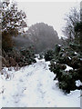
Snowy Bridleway
This is part of one of the bridleways near the railway bridge in White Hart Lane.
Image: © terry joyce
Taken: 6 Dec 2010
0.09 miles